El Molar (Madrid)
| El Molar El Molar | |||
|---|---|---|---|
| |||
 | |||
| Overblik | |||
| Land | |||
| Autonom region | |||
| Provins | |||
| Amt | Cuenca del Medio Jarama | ||
| Postnr. | 28710 | ||
| Nummerpladebogstav(er) | M | ||
| Demografi | |||
| Indbyggere | 10.052 (2024) | ||
| - Areal | 50,3 km² | ||
| - Befolkningstæthed | 200 pr. km² | ||
| Andet | |||
| Tidszone | UTC+1 | ||
| Højde m.o.h. | 850 m | ||
| Hjemmeside | www.elmolar.org | ||
| Oversigtskort | |||
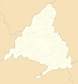
| Kommunens beliggenhed i Madrid-regionen | |||
(c) Miguillen, CC BY-SA 3.0 El Molar | |||
El Molar er en by og kommune i det centrale Spanien i Madrid-regionen. Den har et indbyggertal på 10.052 (2024) indbyggere.
Referencer
Eksterne henvisninger
| Spire |
Medier brugt på denne side
Forfatter/Opretter: See file history, Licens: CC0
Flag of the Community of Madrid (Spain)
Forfatter/Opretter: Roi González Villa (Vivaelcelta), Licens: CC BY-SA 3.0
Location map of Spain
Equirectangular projection, N/S stretching 130 %. Geographic limits of the map:
- N: 44.4° N
- S: 34.7° N
- W: 9.9° W
- E: 4.8° E
Forfatter/Opretter: jynus, Licens: CC BY-SA 3.0
Silhouette of Spain with Spanish Flag.
Forfatter/Opretter: Tschubby, Licens: CC BY-SA 3.0
Gemeinde El Molar
Forfatter/Opretter: Andrey Filippov 安德烈 from Moscow, Russia, Licens: CC BY 2.0
Madrid, Spain
Forfatter/Opretter: SanchoPanzaXXI, Licens: CC BY-SA 4.0
Escudo municipal de El Molar (Madrid): Partido y medio cortado. Primero,en campo de oro, sobre ondas de azur y plata un chorro de agua de plata que en su cima se divide en dos, atravesado en su base, sumado a las ondas un toro de sable. Segundo, en campo de oro una faja de gules. Tercero, en campo de gules una banda de oro, con seis tronquillos de sinople, acompañada de dos lobos de sable en lo alto y dos en lo bajo. Al timbre, Corona Real cerrada. (B.O.E., de 25 de abril de 1975).


