Dong Hoi
| Dong Hoi | |
|---|---|
 Dong Hoi | |
| Overblik | |
| Land | |
| Demografi | |
| Centrum | (2004) |
| - Areal | 155,54 km² |
| Andet | |
| Tidszone | UTC +7 |
| Højde m.o.h. | 20 m |
| Hjemmeside | www.donghoi.gov.vn |
| Oversigtskort | |
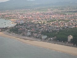
Đồng Hới er en by i det centrale Vietnam med et indbyggertal (pr. 2004) på cirka 103.000. Byen er hovedstad i Quang Binh. Byen ligger ved kysten til det Sydkinesiske hav, og er en af landets vigtigste havnebyer. Dong Hoi Lufthavn er beliggende ved byen. Phong Nha-Ke Bang, en nationalpark som i 2003 kom på UNESCOs verdensarvsliste, ligger 50 km syd for Dong Hoi.
| Spire |
Medier brugt på denne side
Flag map of Vietnam
Nhat Le River, Quang Binh, Vietnam
Forfatter/Opretter: Nguyên Lê, Licens: CC0
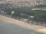
Bao Ninh Beach, Dong Hoi City, Vietnam. The beach is near the 4-star Sun Spa Resort.
Forfatter/Opretter: Uwe Dedering, Licens: CC BY-SA 3.0
Location map of Vietnam.
Equirectangular projection. Strechted by 104 %. Geographic limits of the map:
- N: 24.0° N
- S: 8.0° N
- W: 101.8° E
- E: 110.3° E
Paracel Islands (map between). Equirectangular projection. Stretched by 52%. Geographic limits of the map:
- N: 17°15′ N
- S: 15°45′ N
- W: 111°00′ E
- E: 113°00′ E
Spratly Islands (map below). Equirectangular projection. Stretched by 41.6%. Geographic limits of the map:
- N: 12°00' N
- S: 6°12' N
- W: 111°30' E
- E: 117°20' E
Dong Hoi, Quang Binh, Vietnam


