Delmas (Haiti)
| Delmas | |
|---|---|
| Hovedby | Port-au-Prince |
| Land | |
| Provins | Ouest |
| Arrondissement | Port-au-Prince |
| 18°32′41″N 72°18′10″V / 18.54472°N 72.30278°VKoordinater: 18°32′41″N 72°18′10″V / 18.54472°N 72.30278°V | |
Delmas (haitisk kreol: Dèlma) er en by i Port-au-Prince Arrondissement, provinsen Ouest i Haiti med adskillige hundredtusinder indbyggere[1] og danner med Port-au-Prince, Pétionville og Carrefour det såkaldte Aire Metropolitaine.
Denne[2] internetside tyder på omfattende ødelæggelser i Delmas-området efter jordskælvet 12. januar 2010.
Referencer
- ^ Den tyske Wikipedia-artikel nævner at tallene svinger meget fra: 377.000 i 2005 til næsten 700.000 i 2003.
- ^ "Haiti Earthquake: the Delmas area of Port au Prince is destroyed | Demotix.com". Arkiveret fra originalen 26. januar 2010. Hentet 24. januar 2010.
| ||||||||||||||||||||||||||
|
| Infoboks uden skabelon Denne artikel har en infoboks dannet af en tabel eller tilsvarende. |
Medier brugt på denne side
The national and official state flag of Haiti; arms obtained from File:Coat of arms of Haiti.svg. The civil flag can be found at here.
Forfatter/Opretter: Tango Project], Gnome, og VisualEditor team, Licens: GPL
Icon used to indicate a list
Forfatter/Opretter: Jackaranga, Licens: CC BY-SA 3.0
Locator map of Haiti, using the standard colours from fr:Aide:Cartographie, and a plate carré projection. Map boundaries:
West: -74.614641 East: -71.387348 North: 20.33042
South: 17.818522Forfatter/Opretter: Logan Abassi / UNDP Global, Licens: CC BY 2.0
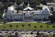
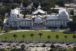
The Haitian National Palace (Presidential Palace), located in Port-au-Prince, Haiti, heavily damaged after the earthquake of January 12, 2010. Note: this was originally a two-story structure; the second story completely collapsed.


