Davenport (Iowa)
| Davenport | |||
|---|---|---|---|
| |||
 | |||
| Overblik | |||
| Land | |||
| Borgmester | Mike Matson[1] | ||
| Delstat | |||
| County | Scott County | ||
| Grundlagt | 14. maj 1836 | ||
| Postnr. | 52801–52809, 52801, 52803, 52805, 52809 | ||
| Telefonkode | 563 | ||
| UN/LOCODE | USDVN | ||
| Demografi | |||
| Indbyggere | 101.724 (2020)[2] | ||
| - Areal | 168 km² | ||
| - Befolkningstæthed | 604 pr. km² | ||
| Andet | |||
| Tidszone | UTC−06:00 | ||
| Højde m.o.h. | 180 m | ||
| Hjemmeside | www.cityofdavenportiowa.com | ||
| Oversigtskort | |||
Davenport er en by i delstaten Iowa i Midtvesten i USA. Byen har et indbyggertal på 101.724 (2020)[2] indbyggere og et areal på 168 km2 . Den er hovedby i det amerikanske county Scott County.
Davenport blev grundlagt i 1836 og ligger langs Mississippifloden, der her danner grænse til delstaten Illinois.
Referencer
- ^ www.davenportiowa.com, hentet 30. maj 2022 (fra Wikidata).
- ^ a b USA's folketælling fra 2020, hentet 1. januar 2022 (fra Wikidata).
Eksterne henvisninger
- Officiel hjemmeside (engelsk)
| Spire |
Medier brugt på denne side
Forfatter/Opretter: NordNordWest, Licens: CC BY-SA 3.0
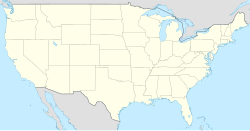
Location map of the United States ("lower 48")
(c) Lokal_Profil, CC BY-SA 2.5
Map showing Mainland USA ("lower 48") with a superimposed US flag.
Forfatter/Opretter: Farragutful, Licens: CC BY-SA 3.0
A montage of pictures of the city of Davenport, Iowa.
Forfatter/Opretter: Original by Dov Gutterman, SVG by Jack Ryan Morris (SaluteVII), Licens: CC BY-SA 3.0
The City of w:Davenport, Iowa, officially adopted this flag on December 6th, 2000. The colors used in the Flag for the City of Davenport are taken from the Flags of the United States, the State of Iowa, and France (The French Colonial Territory before the Louisiana Purchase in 1803). On the top left corner, a blue box with a yellow outline includes the year w:1836, the year Davenport was incorporated, surveyed, and laid in lots by w:Major William Gordon. Two lines, one red and another blue cross through the flag, and are covered by a white box with a yellow outline with the city symbol in it. The red signifies hardiness and valor, white purity and innocence, the blue signifies vigilance, perseverance, and justice, and the yellow signifies "the golden rule or principle of treating others as one wants to be treated". Below the center lies the words "City of Davenport", in all capital letters.
Forfatter/Opretter: Alexrk2, Licens: CC BY 3.0
Grafik blev lavet med GeoTools. .


