Cuyahoga Valley National Park
| Cuyahoga Valley National Park | |
|---|---|
 Cuyahoga River | |
| Ligger i | USA |
| Område | |
| Nærmeste by | Akron |
| Areal | 133 km² |
| Oprettet | 21. oktober 2000 |
| Oversigtskort | |
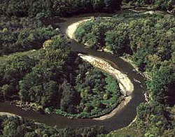
Cuyahoga Valley National Park er en nationalpark i delstaten Ohio, USA. Parken blev etableret 21. oktober 2000, og er på 133 km². De vigtigste naturattraktioner i nationalparken er landskabet langs Cuyahogafloden mellem Akron og Cleveland i den nordøstlige del af delstaten Ohio i USA.
Parken har vandfald, bakker, vandrestier og udstillinger af tidligt landliv. Vandrestien Ohio and Erie Canal Towpath Trail følger kanalen Ohio and Erie Canal, hvor muldyr trak kanalbåde. Parken har mange historiske hjem, broer og andre bygninger.
Parken er den eneste nationalpark i Ohio. Cuyahoga betyder «krogede flod» på Mohawk-sproget. Den blev oprindelig oprettet som et «US National Recreational Area» 27. december 1974, og gjort om til nationalpark af Kongressen 11. oktober 2000.
Se også
Eksterne kilder/henvisninger
Koordinater: 41°14′N 81°33′V / 41.24°N 81.55°V
|
Medier brugt på denne side
Forfatter/Opretter: NordNordWest, Licens: CC BY-SA 3.0
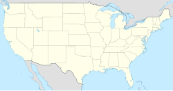
Location map of the United States ("lower 48")
Logo of the United States National Park Service, an agency of the United States Department of the Interior. This version is shaded to look as if it has been carved out of wood or rock. The elements on the logo represent the major facets of the national park system. The Sequoia tree and bison represent vegetation and wildlife, the mountains and water represent scenic and recreational values, and the arrowhead represents historical and archeological values. The bison is also the symbol of the Department of the Interior. The logo became the official logo on July 20, 1951, replacing the previous emblem of a Sequoia cone, and has been used ever since. The design was slightly updated in 2001, and a few different renderings are used today. For more information, see here and here.[dead link]


