Crater Lake National Park
| Crater Lake National Park | |
|---|---|
 Luftfoto over Crater Lake. | |
| Ligger i | |
| Område | |
| Nærmeste by | Medford |
| Areal | 741 km² |
| Oprettet | 22. maj 1902 |
| Oversigtskort | |
Crater Lake National Park er en nationalpark i den sydlige del af delstaten Oregon i USA. Parken har navn efter Crater Lake og blev etableret 22. maj 1902, hvilket gør den til USAs sjette ældste nationalpark. Parken har et areal på 741 km². De vigtigste naturattraktioner i nationalparken er en caldera, Der udgør resterne af den ødelagte vulkan, Mount Mazama som blev dannet for 7.700 år siden efter et udbrud og er fyldt med vand.
Søen er med en dybde på 597 m, den dybeste sø i USA, den næstdybeste sø i Amerika og nummer syv på listen over verdens dybeste søer. Kanten på calderaen varierer i fra 2.100 til 2.400 moh. Den gennemsnitlige højde på selve søen er 1.883 moh. Crater Lake har oftest en skarp blå farve, og har hverken til- eller afløb.
Eksterne kilder/henvisninger
Koordinater: 42°56′N 122°06′V / 42.94°N 122.1°V
|
Medier brugt på denne side
Forfatter/Opretter: NordNordWest, Licens: CC BY-SA 3.0
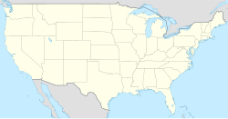
Location map of the United States ("lower 48")
Logo of the United States National Park Service, an agency of the United States Department of the Interior. This version is shaded to look as if it has been carved out of wood or rock. The elements on the logo represent the major facets of the national park system. The Sequoia tree and bison represent vegetation and wildlife, the mountains and water represent scenic and recreational values, and the arrowhead represents historical and archeological values. The bison is also the symbol of the Department of the Interior. The logo became the official logo on July 20, 1951, replacing the previous emblem of a Sequoia cone, and has been used ever since. The design was slightly updated in 2001, and a few different renderings are used today. For more information, see here and here.[dead link]
Flag of Oregon (obverse): The flag was adopted by the state on February 26, 1925.[1] The state seal was decided in 1903.[2][3]
Forfatter/Opretter: Zainubrazvi, Licens: CC BY-SA 3.0
Crater Lake is a caldera lake in the south of U.S. state of Oregon. It is the main feature of Crater Lake National Park and famous for its deep blue color and water clarity. With a maximum depth of almost 1950 feet (594 m) the lake partly fills a nearly 4,000 feet (1,220 m) deep caldera that was formed around 2000 (± 150) BC by the collapse of the volcano Mount Mazama.


