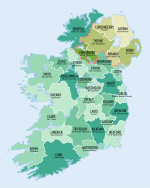
County Wexford

County Wexford (irsk: Contae Loch Garman) er et county i Republikken Irland, hvor det ligger i provinsen Leinster.
Byen blev grundlagt i 1210.1210[1] County Wexford omfatter et areal på 2.352 km² med en samlet befolkning på 163.527 i 2022.[2]
Det administrative county-center ligger i byen Wexford.
I området Bargy (tidligere baroni) bliver den særlige sprogstamme yola, der stammer far middelalderen, tales stadig.
Byer og landsbyer
- Adamstown
- Arthurstown
- Ballycanew
- Ballycullane
- Ballyedmond
- Ballyfad
- Ballygarrett
- Ballyhack
- Ballymitty
- Ballywilliam
- Bannow
- Barntown
- Blackwater
- Bree
- Bridgetown
- Broadway
- Bunclody
- Camolin
- Campile
- Castlebridge
- Castletown
- Cleariestown
- Clohamon
- Clonroche
- Coolgreany
- Courtown
- Craanford
- Crossabeg
- Cullenstown
- Curracloe
- Duncannon
- Duncormick
- Enniscorthy
- Ferns
- Fethard-on-Sea
- Foulkesmill
- Gorey
- Hollyfort
- Inch
- Killinierin
- Kilmore
- Kilmore Quay
- Kilmuckridge
- Kiltealy
- Monamolin
- Monaseed
- Murrintown
- Monageer
- Monbeg
- Newbawn
- New Ross
- Oulart
- Oylegate
- Poulpeasty
- Rathangan
- Rosslare
- Rosslare Harbour
- Raheen
- Rathnure
- Saltmills
- Taghmon
- Watch House Village
- Wellingtonbridge
- Wexford
Seværdigheder
Bannow Drive, der er en rute igennem fire de landsbyer Duncormick, Cullenstown, Bannow og Wellingtonbridge, og dette er en populær turistattraktion i Wexford.
Ballyteigue Burrow, nær Duncormick, er en af de bedst beskyttede klitsystemer i Irland. Her er rigt flora og fauna, og de omkring 9 km kyststrækning er beskyttet som naturreservat i Ballyteigue Bay.
Hook Peninsula er kendt for sine mange strande og udsigter. Her findes også fyrtårnet Hook Head og Loftus Hall.
Der er populære strande i Courtown, Curracloe, Carnsore Point, Duncannon og Rosslare Strand.
- Andre steder inkluderer
- Ferns Castle and Abbey[3]
- Enniscorthy Castle and Museum
- Vinegar Hill
- National 1798 Visitor Centre[4]
- Boolavogue
- The Browne-Clayton Monument
- Oulart Hill
- Castleboro House[5]
- The Seven 'Castles' of Clonmines
- Johnstown Castle
- Dollar Bay
- Loftus Hall – Forladt hjemsøgt hus (den første sal blev opført på stedet i 1350)
- Ballyteigue Castle
- Bannow Church (dateret til 1200-tallet)
- Selskar Abbey, Wexford
- Irish National Heritage Park (Ferrycarrig)
- Tacumshin windmill (southeast County Wexford)
- St. Mary's Church, New Ross
- Dunbrody Abbey
- Tintern Abbey[6]
- Slade Castle
- Ballyhack Castle
- J.F. Kennedy homestead and park
- Slieve Coilte
- Wells House and Gardens
- Duncannon Fort
- Saltee Islands
Referencer
- ^ "County Wexford – Topographical Dictionary of Ireland (1837)". www.libraryireland.com. Arkiveret fra originalen 22. juni 2019. Hentet 22. juni 2019.
- ^ "Census of Population 2022 – Preliminary Results". Central Statistics Office (Ireland). Hentet 26. maj 2023.
- ^ "Ferns Castle". Heritage Ireland website. Arkiveret fra originalen 3. maj 2008. Hentet 15. maj 2008.
- ^ "National 1798 Visitor Centre". National 1798 Visitor Centre Website. Arkiveret fra originalen 11. maj 2008. Hentet 15. maj 2008.
- ^ "Castleboro House, burned 1923". Abandoned Ireland. Arkiveret fra originalen 25. januar 2011.
- ^ "Dunbrody Abbey". Dunbrody Abbey Visitors Centre Website. Arkiveret fra originalen 9. maj 2008. Hentet 16. maj 2008.
Eksterne henvisninger
| |||||||||||||||||||||||||
|
| Spire |
Koordinater: 52°30′00″N 6°40′00″V / 52.5°N 6.6666666666667°V
Medier brugt på denne side
Forfatter/Opretter:
- Population_density_of_Ireland_map2002.svg: *Ireland_complete.svg: Future Perfect at Sunrise
- derivative work: The Illusional Ministry (talk)
- derivative work: Sswonk (talk)
Map of Ireland's counties with names, Northern Ireland counties colored tan
Forfatter/Opretter:
- Island_of_Ireland_location_map.svg: *Ireland_location_map.svg: NordNordWest
- Northern_Ireland_location_map.svg: NordNordWest
- Northern_Ireland_-_Counties.png: Maximilian Dörrbecker (Chumwa)
- derivative work: Rannpháirtí anaithnid (talk)
- derivative work: Mabuska (talk)
The island of Ireland, showing international border between Northern Ireland and Republic of Ireland, traditional provinces, traditional counties, and local authority areas in the Republic of Ireland and Northern Ireland.
Forfatter/Opretter: Caomhan27, Licens: CC BY-SA 3.0
Flag of Ulster (heraldic banner of traditional coat of arms of the province, not to be confused with the former flag of Northern Ireland).
Map of Ireland with flag.
Forfatter/Opretter: First author Caomhan27, Licens: CC BY-SA 3.0
Flag of w:Connacht.


