County Westmeath
County Westmeath (irsk: Contae na hIarmhí) er et county i Republikken Irland, hvor det ligger i provinsen Leinster.
County Westmeath omfatter et areal på 1.764 km² med en samlet befolkning på 79.403 (2006).
Det administrative county-center ligger i byen Mullingar.
| |||||||||||||||||||||||||
|
| Spire |
Koordinater: 53°30′N 7°30′V / 53.5°N 7.5°V
Medier brugt på denne side
Forfatter/Opretter:
- Population_density_of_Ireland_map2002.svg: *Ireland_complete.svg: Future Perfect at Sunrise
- derivative work: The Illusional Ministry (talk)
- derivative work: Sswonk (talk)
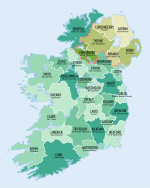
Map of Ireland's counties with names, Northern Ireland counties colored tan
Forfatter/Opretter:
- Island_of_Ireland_location_map.svg: *Ireland_location_map.svg: NordNordWest
- Northern_Ireland_location_map.svg: NordNordWest
- Northern_Ireland_-_Counties.png: Maximilian Dörrbecker (Chumwa)
- derivative work: Rannpháirtí anaithnid (talk)
- derivative work: Mabuska (talk)
The island of Ireland, showing international border between Northern Ireland and Republic of Ireland, traditional provinces, traditional counties, and local authority areas in the Republic of Ireland and Northern Ireland.
Forfatter/Opretter: Caomhan27, Licens: CC BY-SA 3.0
Flag of Ulster (heraldic banner of traditional coat of arms of the province, not to be confused with the former flag of Northern Ireland).
Map of Ireland with flag.
Forfatter/Opretter: First author Caomhan27, Licens: CC BY-SA 3.0
Flag of w:Connacht.


