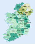
County Louth
County Louth (irsk: Contae Lú) er et county i Republikken Irland, hvor det ligger i provinsen Leinster.
County Louth omfatter et areal på 820 km² med en samlet befolkning på 110.894 (2006). Det er dermed Irlands arealmæssigt mindste county.
Det administrative county-center ligger i byen Dundalk, men den største by er dog Drogheda, der er blot en smule større end Dundalk.
Eksterne links
| |||||||||||||||||||||||||
|
| Spire |
Koordinater: 53°50′00″N 6°30′00″V / 53.833333333333°N 6.5°V
Medier brugt på denne side
Map of Ireland with flag.
Forfatter/Opretter:
- Island_of_Ireland_location_map.svg: *Ireland_location_map.svg: NordNordWest
- Northern_Ireland_location_map.svg: NordNordWest
- Northern_Ireland_-_Counties.png: Maximilian Dörrbecker (Chumwa)
- derivative work: Rannpháirtí anaithnid (talk)
- derivative work: Mabuska (talk)
The island of Ireland, showing international border between Ireland and Northern Ireland, traditional provinces, traditional counties, and local authority areas in Ireland and Northern Ireland.
Forfatter/Opretter:
- Population_density_of_Ireland_map2002.svg: *Ireland_complete.svg: Future Perfect at Sunrise
- derivative work: The Illusional Ministry (talk)
- derivative work: Sswonk (talk)
Map of Ireland's counties with names, Northern Ireland counties colored tan
Forfatter/Opretter: Caomhan27, Licens: CC BY-SA 3.0
Flag of Ulster (heraldic banner of traditional coat of arms of the province, not to be confused with the former flag of Northern Ireland).
Forfatter/Opretter: First author Caomhan27, Licens: CC BY-SA 3.0
Flag of w:Connacht.


