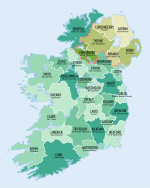
County Armagh
County Armagh (Irsk: Contae Ard Mhacha) er et af de seks counties, der udgør Nordirland og et af de ni counties, som historisk og geografisk udgør provinsen Ulster som er delt mellem Nordirland (United Kingdom) og Republikken Irland.
County Armagh omfatter et areal på 1.254 km² med en samlet befolkning på 159.085 (2006).
Det administrative county-center ligger i byen Armagh.
Eksterne links
| |||||||||||||||||||||||||
| Wikimedia Commons har medier relateret til: |
Koordinater: 54°21′00″N 6°39′17″V / 54.3499°N 6.6546°V
|
Medier brugt på denne side
Location of County Armagh (Condae Ard Mhacha) (light green) within Northern Ireland (pink) in the island of Ireland (green)
Forfatter/Opretter:
- Population_density_of_Ireland_map2002.svg: *Ireland_complete.svg: Future Perfect at Sunrise
- derivative work: The Illusional Ministry (talk)
- derivative work: Sswonk (talk)
Map of Ireland's counties with names, Northern Ireland counties colored tan
Forfatter/Opretter: Caomhan27, Licens: CC BY-SA 3.0
Flag of Ulster (heraldic banner of traditional coat of arms of the province, not to be confused with the former flag of Northern Ireland).
Forfatter/Opretter: First author Caomhan27, Licens: CC BY-SA 3.0
Flag of w:Connacht.


