Cormet de Roselend
| Cormet de Roselend | |
|---|---|
 | |
| Højde | 1.968 m.o.h.[1] |
| Længde | 40 km[2] |
| Krydses af | Fransk landevej D902 og D925[3] |
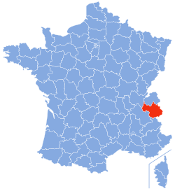
| Sted | Savoie-departementet |
| Koordinater | 45°41′28″N 6°41′26″Ø / 45.69111°N 6.69056°ØKoordinater: 45°41′28″N 6°41′26″Ø / 45.69111°N 6.69056°Ø |
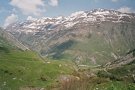
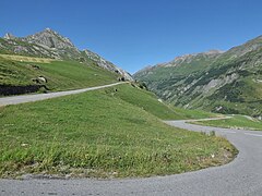
Cormet de Roselend (1.968[1] m.o.h.) er et bjergpas i Frankrig. Det ligger i departementet Savoie og krydses af landevejen D902 og D925. Det forbinder Tarentaise-dalen med byen Beaufort.[4] Landevejen D902 går fra hovedbyen i Tarentaise-dalen Bourg-Saint-Maurice til toppen af bjergpasset.[5] Fra Bourg-Saint-Maurice går D902 gennem Vallée des Chapieux.[6] Fra passets toppunkt går landevej D925 til Vallée du Beaufortain.[7]
Galleri
Lac du Roselend
Landevejen D902 fra Bourg-Saint-Maurice
Kildehenvisninger
- ^ a b "geoportail.gouv.fr, cormet-de-roselend". Hentet 25. juli 2019.
- ^ "Google Maps, Bourg-Saint-Maurice - Beaufort". Hentet 26. maj 2019.
- ^ "Google Maps, D902 og D925". Hentet 26. maj 2019.
- ^ "Google Maps, Cormet de Roselend". Hentet 8. september 2018.
- ^ "Google Maps, Bourg-Saint-Maurice - Cormet de Roselend". Hentet 21. september 2018.
- ^ "geoportail.gouv.fr, Vallée des Chapieux". Hentet 1. august 2019.
- ^ "geoportail.gouv.fr, Beaufortain". Hentet 1. august 2019.
Eksterne henvisninger
| ||||||||||||
| Spire Denne artikel om et fransk naturområde er en spire som bør udbygges. Du er velkommen til at hjælpe Wikipedia ved at udvide den. |
|
Medier brugt på denne side
Map showing France with the ch flag.
Forfatter/Opretter: Eric Gaba (Sting - fr:Sting), Licens: CC BY-SA 3.0
Blank physical map of the department of Savoie, France, for geo-location purpose.
Scale : 1:800,000 (precision : 200 m)
Forfatter/Opretter: Marmelad, Licens: CC BY-SA 2.5
Autogenerated image to indicate departement given by filename.
Forfatter/Opretter: Florian Pépellin, Licens: CC BY-SA 3.0
Sight of the French RD 902 road approaching the Cormet de Roselend pass (1 968 m high), in Savoie.
(c) Stephan Brunker, CC BY-SA 3.0
Sight of the lac de Roselend lake, in Savoie, France.
Forfatter/Opretter: Jesper Bøtker Mortensen, Licens: CC BY-SA 4.0
Signpost at the pass as of july 2018
Forfatter/Opretter: Jesper Bøtker Mortensen, Licens: CC BY-SA 4.0
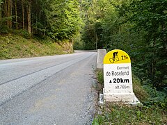
First signpost with climb details coming up from the city Beaufort
Forfatter/Opretter: Eric Gaba (Sting - fr:Sting), Licens: CC BY-SA 4.0
Blank physical map of metropolitan France for geo-location purpose.
Scale : 1:14 816 000 (accuracy : about 3,7 km) for the bathymetry. More maps of France, view → Commons Atlas of France.
Forfatter/Opretter: Florian Pépellin, Licens: CC BY-SA 3.0
Sight of the French RD 925 road to the Cormet de Roselend pass, here on the heights of the Roselend lake, in Savoie.


