Compton (månekrater)
| Månekrater | ||
|---|---|---|
| Compton | ||
 Comptonkrateret set mod vest fotograferet af Lunar Orbiter 5 i 1967 | ||
| Karakteristika | ||
| Bredde Længde | [1][2] | |
| Diameter | 162 km [1][2] | |
| Dybde | ukendt [3][4] | |
| 260° [4] | ||
| Opkaldt efter | Arthur H. Compton Karl T. Compton [2][5][3] | |
| Fra periode | Nedre Imbrian [4][6] | |
| Kraterets placering | ||
| Månen - Selenografi - () | ||
Find flere artikler om astronomi på Astronomiportalen | ||

Compton er et fremtrædende nedslagskrater på Månen. Det befinder sig på den nordlige halvkugle på Månens bagside og er opkaldt efter de amerikanske fysikere, nobelprismodtageren Arthur H. Compton (1892 – 1962) og Karl T. Compton (1887 – 1954).
Navnet blev officielt tildelt af den Internationale Astronomiske Union (IAU) i 1970. [2][5][7]
Omgivelser
Comptonkrateret ligger øst for Mare Humboldtianum og sydvest for den bjergomgivne slette Schwarzschild. Sydøst for Compton ligger det stærkt eroderede Swannkrater. [8]
Karakteristika
Krateret er i store træk cirkulært med en bred, irregulær ydre rand, hvor bredden varierer betragteligt. Dele af de indre vægge har terrasser, som danner brede hylder ned ad kanten. Inden for væggen er kraterbunden blevet dækket af lavastrømme på et tidspunkt i fortiden. Denne overflade har lavere albedo end omgivelserne og har altså en lidt mørkere farvetone.
I kraterets midte er der en bjergformation, som udgør den centrale top. Denne formation er omgivet af en ring af bakker, som ligger i en halvcirkel i kraterets vestlige halvdel med en radius, der er omkring halvdelen af den indre vægs. Disse bakker danner takkede spidser gennem den lavadækkede overflade og ligger med uregelmæssige mellemrum mellem sig.
I kraterbunden er der desuden en del snævre riller indenfor ringen af bakker. De ligger særligt i den nordvestlige del af bunden. Bortset fra et lille, skålformet krater nær den østlige rand indeholder bunden kun få småkratere.
Satellitkratere
De kratere, som kaldes satellitter, er små kratere beliggende i eller nær hovedkrateret. Deres dannelse er sædvanligvis sket uafhængigt af dette, men de får samme navn som hovedkrateret med tilføjelse af et stort bogstav. På kort over Månen er det en konvention at identificere dem ved at placere dette bogstav på den side af satellitkraterets midte, som ligger nærmest hovedkrateret.[9][10][11] Comptonkrateret har følgende satellitkratere:
| Compton | Længde | Bredde | Diameter |
|---|---|---|---|
| E | 55,4° N | 113,4° Ø | 19 km |
| R | 52,6° N | 91,5° Ø | 37 km |
| W | 58,6° N | 97,2° Ø | 16 km |
Måneatlas
Se også
- Månekratere – Liste over kratere på Månen
- Navne på Månens have – Liste over have på Månen
Navigation
Kilder
- ^ a b NASAs side om månekratere:"Moon nomenclature -Crater". The Lunar Prospector Website, NASA Ames Research Center. Arkiveret fra originalen 14. juli 2007. Hentet 21. marts 2009. (engelsk)
- ^ a b c d Deskriptive data om månekratere på hjemmesiden fra USAs geologiske institut. ( Klik på det relevante navn ) :"Gazetteer of Planetary Nomenclature - Moon Nomenclature: Crater, craters". Astrogeology Research Program, U.S. Geological Survey. Hentet 2007-08-05. (engelsk)
- ^ a b Compton på Wikien The Moon Arkiveret 2. august 2012 hos Wayback Machine (engelsk)
- ^ a b c Program (under GNU-licens) og integreret database:"Atlas Virtuel de la Lune". Portail de l'Astronomie en France af Patrick Chevalley og Christian Legrand. Arkiveret fra originalen 14. maj 2008. Hentet 21. marts 2009. (fransk)
- ^ a b Liste over officielle navne på månekratere fra en tysk astronomihjemmeside :"Krater mit individuellem Namen (Kratere med individuelle navne)". www.astrolink.de. (tysk)
- ^ (engelsk)Tompkins, S. & C.M. Pieters (1999). Meteoritics & Planetary Science, vol. 34, no. 1, side 25-41 (red.). Mineralogy of the lunar crust: Results from Clementine.
{{cite book}}: CS1-vedligeholdelse: Flere navne: editors list (link) (i pdf- eller gif-format). - ^ I almindelighed tildelte IAU officielle navne til kratere på Månens forside i 1935, til kratere på Månens bagside i 1970, og endelig har visse mindre kratere (der tidligere ansås som satellitkratere) fået nye navne fra 1973 og fremefter. Se :
- USAs geologiske undersøgelser :"Gazetteer of Planetary Nomenclature - History of Planetary Nomenclature". Astrogeology Research Program, U.S. Geological Survey.. (engelsk)
- Mario Tessier (1998). "La cartographie lunaire: des origines au XXeme siècle (Månens kartografi: Fra begyndelsen til 20. århundrede)". Nox Oculis. Arkiveret fra originalen 5. december 2008. Hentet 21. marts 2009.
{{cite web}}: Ekstern henvisning i|author=
- ^ Lpi-måneatlas
- ^ Bussey, B.; Spudis, P. (2004). The Clementine Atlas of the Moon. New York: Cambridge University Press. ISBN 0-521-81528-2. (engelsk)
- ^ U.S. Geological Survey. "Coded Topography and Shaded Relief Maps of the Moon". Astrogeology Research Program. (engelsk)
- ^ Fuldstændig nomenklatur for månekratere :Jonathan McDowell (2004). "Lunar Craters". Lunar Nomenclature. (engelsk)
Eksterne henvisninger
- 1) Henvisninger, som specielt retter sig mod Compton
(Bemærk, at kraternavne med specialkarakter, herunder mellemrum, kan kræve søgning på de nævnte internetsider)
- Billeder af stedet i flere udgaver, baseret på optagelser fra sonden Clementine (1994) og vist på http://pdsmaps.wr.usgs.gov/ Map-a-Planet (Astrogeology Research Program), U.S. Geological Survey:
- Monokromt (et bånd ved bølgelængde på 750 nanometer giver et sort/hvidt billede;
- Naturlige farver (fem bølgelængder: 415, 750, 900, 950 og 1000 nanometer);
- Kunstige farver (Blå og grønne er de lavestliggende områder, røde og grønne de højere);
- Relieffarver (viser topografien i farverne rød (750 nm/415 nm), grøn (750 nm/950 nm) og blå (414 nm/750 nm) i en farveblanding, som fjerner dominerende klarhedsfaktorer som albedo og skyggevirkninger. Se også farveindexet).
- En nærmere forklaring på den anvendte fotografiske teknik findes på denne hjælpeside (engelsk).
- "Præcis beliggenhed og overblik over stedet". www.geody.com/?world=moon Geody - søgemaskine for steder på Merkur, Venus, Jorden, Månen, Mars og i rummet (støttet af Google Earth, NASA World Wind, Celestia og Stellarium. (hjemmeside under Creative Commons-licens , se http://www.geody.com/legal.php).
- Søgning af fotografier, kort og dokumentation vedrørende Compton på"Lunar and Planetary Institutes søgemaskine". www.lpi.usra.edu/ (Hjemmeside for Lunar and Planetary Institute, Universities Space Research Association).(engelsk)
- 2) Generel information om overfladedannelser på Månen
- Deskriptive data og geologiske kort over detaljer på måneoverfladen ifølge IAU, vist på hjemmesiden fra USAs geologiske institut:"Gazetteer of Planetary Nomenclature - Moon Nomenclature Table Of Contents". planetarynames.wr.usgs.gov/ Astrogeology Research Program, U.S. Geological Survey (engelsk).
- NASAs side om månekratere:"Moon nomenclature -Crater". lunar.arc.nasa.gov/ The Lunar Prospector Website, NASA Ames Research Center. (engelsk)
- Wikiprojekt til samling af informationer om Månens overflade (The-Moon Wiki) på http://the-moon.wikispaces.com/. (engelsk)
- Program og integreret database på:Patrick Chevalley og Christian Legrand. "Atlas Virtuel de la Lune". www.astrosurf.com/ Portail de l'Astronomie en France. (fransk)
Bibliografi
- Andersson, L. E.; Whitaker, E. A. (1982). NASA Catalogue of Lunar Nomenclature (NASAs katalog over månenomenklatur). NASA RP-1097.
- Bussey, B.; Spudis, P. (2004). The Clementine Atlas of the Moon (Clementine-atlas over Månen). New York: Cambridge University Press. ISBN 0-521-81528-2.
- Cocks, Elijah E.; Cocks, Josiah C. (1995). Who's Who on the Moon: A Biographical Dictionary of Lunar Nomenclature (Hvem er hvem på Månen: En biografisk ordbog over månenomenklatur). Tudor Publishers. ISBN 0-936389-27-3.
- McDowell, Jonathan (15. juli 2007). "Lunar Nomenclature (Månenomenklatur)". Jonathan's Space Report. Hentet 2007-10-24.
- Menzel, D. H.; Minnaert, M.; Levin, B.; Dollfus, A.; Bell, B. (1971). "Report on Lunar Nomenclature by The Working Group of Commission 17 of the IAU (Rapport over månenomenklatur fra arbejdsgruppen under kommission 17 hos IAU)". Space Science Reviews. 12: 136.
- Moore, Patrick (2001). On the Moon (På Månen). Sterling Publishing Co. ISBN 0-304-35469-4.
- Price, Fred W. (1988). The Moon Observer's Handbook (Månebetragterens håndbog). Cambridge University Press. ISBN 0521335000.
- Rükl, Antonín (1990). Atlas of the Moon (Måneatlas). Kalmbach Books. ISBN 0-913135-17-8.
- Webb, Rev. T. W. (1962). Celestial Objects for Common Telescopes (Himmelobjekter for almindelige teleskoper) (6th revision udgave). Dover. ISBN 0-486-20917-2.
- Whitaker, Ewen A. (1999). Mapping and Naming the Moon (Månens kortlægning og navngivning). Cambridge University Press. ISBN 0-521-62248-4.
- Wlasuk, Peter T. (2000). Observing the Moon (Måneobservation). Springer. ISBN 1-85233-193-3.
Medier brugt på denne side
Forfatter/Opretter: Rursus, Licens: CC BY-SA 3.0
Replacement for faulty
 (note the ring "around" Saturn!)
 Red dot
The Earth straddling the limb of the Moon, as seen from Lunar Reconnaissance Orbiter above Compton crater. The shadow in the foreground is from the crater's central peaks, while the mountains just above it can be seen in the 10 o'clock position within the crater in this image or the 12 o'clock position in this image. The center of the Earth in this view is 4.04°N, 12.44°W, just off the coast of Liberia. The large tan area in the upper right is the Sahara desert, and just beyond is Saudia Arabia. The Atlantic and Pacific coasts of South America are visible to the left.
From the Earth, the daily Moonrise and Moonset are always inspiring moments. However, lunar astronauts will see something very different: viewed from the lunar surface, the Earth never rises or sets. Since the Moon is tidally locked, the Earth is always in the same spot above the horizon, varying only a small amount with the slight wobble of the Moon. The Earth may not move across the "sky", but the view is not static. Future astronauts will see the continents rotate in and out of view and the ever changing pattern of clouds will always catch one's eye. Well at least on the nearside, but what about the farside? The Earth is never visible from the farside, imagine a sky with no Earth or Moon - what will farside explorers think with no Earth overhead?
This image was taken when LRO was 134 km above the farside crater Compton (51.8°N, 124.1°E). Capturing an image of the Earth and Moon with LROC is a complicated task. First the spacecraft must be rolled to the side (in this case 67°), then the spacecraft slews with the direction of travel to maximize the width of the lunar horizon in the NAC image. All this takes place while LRO is traveling over 1600 meters per second (faster than 3580 mph) relative to the lunar surface below the spacecraft! As a result of these three motions and the fact that the Narrow Angle Camera is a line scanner the raw image geometry is distorted. Also, because the Moon and Earth are so far apart, the geometric correction is different for each body. Reconstruction of the Earth-Moon image is not a simple matter – and that is just to get the black and white image!
What about color? The WAC images the same scene repeatedly while the NAC scans across the scene just once. Since the NAC pixel scale is 75 times smaller than the WAC pixel scale, a straight Earth and Moon composite would show a very fuzzy Earth and a sharp Moon. The LROC team took advantage of the multiple WAC images of the Earth to create a sharpened WAC Earth. For each WAC pixel the Earth was imaged between 20 and 50 times (the WAC FOV moved only a small fraction of a pixel between each image), and these multiple looks were combined (for the Earth only, the Moon as shown is NAC). The colors are only approximately what an intrepid explorer would see from the Moon because the human eye is fully sensitive to all colors across the visible wavelength range, whereas the WAC sees through a set of narrow band filters (the view here combines the 604 nm (orange), 556 nm (yellow-green), and 415 nm (violet) bands displayed in red, green, and blue, respectively).
The Earth is much brighter (higher reflectance) than the Moon, especially from this angle; the Earth was captured near noon while the limb of the Moon was just appearing from the shadows of night, so the Moon was relatively dim. In the opening image the Moon and Earth were contrast-stretched separately to bring out details on the lunar surface. The two contrast stretch makes for a spectacular image, but it may be misleading in a purely scientific sense.
The sharp black outline across the bottom of the Earth is from mountains still on the night side of the lunar terminator.
A blog post by Emily Lakdawalla discusses the creation of this image.
The original NASA image was converted from TIFF to JPEG format by the uploader.Forfatter/Opretter: James Stuby based on NASA image
, Licens: CC0
Oblique view of Compton, on the moon, facing west.
Red dot, based on the image on en:.
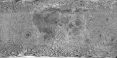
cylindrical map projection of the Moon. The Moon's whole surface was mapped by the Clementine spacecraft in 1994, here North is at the top. The dark floor of crater Plato is at the middle top above Mare Imbrium, while the bright floor and rays of crater Tycho is near the middle bottom below Mare Imbrium. Mare Procellarum is at the near left, and Mare Tranquillitatis is just right of centre and Mare Crisium is at the near right. The far left and far right show the contrast of the mostly cratered farside with small isolated mare.
Forfatter/Opretter: No machine-readable author provided. WikedKentaur assumed (based on copyright claims)., Licens: CC BY-SA 3.0
This is a stack of 10 frames taken through a 150mm Maksutov-Cassegrain telescope.
- Author: en:User:Mdf
- Source: en:Image:Moon-001.jpg 22:36, 14 July 2005 . . Mdf (


