Chapinería
| Chapinería | |||||
|---|---|---|---|---|---|
| |||||
 | |||||
| Overblik | |||||
| Land | |||||
| Borgmester | Ángel Luis Fernández Robles[1] | ||||
| Autonom region | |||||
| Provins | |||||
| Amt | Sierra Oeste de Madrid | ||||
| Postnr. | 28694 | ||||
| Nummerpladebogstav(er) | M | ||||
| Demografi | |||||
| Indbyggere | 2.642 (2024) | ||||
| - Areal | 25,4 km² | ||||
| - Befolkningstæthed | 104 pr. km² | ||||
| Andet | |||||
| Tidszone | UTC+1 | ||||
| Højde m.o.h. | 680 m | ||||
| Hjemmeside | chapineria.madrid | ||||
| Oversigtskort | |||||
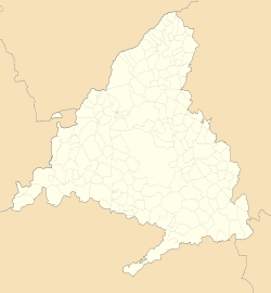
| Kommunens beliggenhed i Madrid-regionen | |||||
(c) Miguillen, CC BY-SA 3.0 Chapinería | |||||
Chapinería er en by og kommune i det centrale Spanien i Madrid-regionen. Den har et indbyggertal på 2.642 (2024) indbyggere.
Referencer
Eksterne henvisninger
| Spire |
Medier brugt på denne side
Forfatter/Opretter: See file history, Licens: CC0
Flag of the Community of Madrid (Spain)
Forfatter/Opretter: Roi González Villa (Vivaelcelta), Licens: CC BY-SA 3.0
Location map of Spain
Equirectangular projection, N/S stretching 130 %. Geographic limits of the map:
- N: 44.4° N
- S: 34.7° N
- W: 9.9° W
- E: 4.8° E
Forfatter/Opretter: jynus, Licens: CC BY-SA 3.0
Silhouette of Spain with Spanish Flag.
Forfatter/Opretter: Dirección General de Turismo. Consejería de Economía e Innovación Tecnológica. Comunidad de Madrid., Licens: CC BY 3.0 es
Recinto de la Iglesia de Chapinería.
Forfatter/Opretter: SanchoPanzaXXI]](Taller de Heráldica y Vexilología in the Spanish Wikipedia
Escudo municipal de Chapinería (Madrid): Partido. Primero, en campo de gules, borceguí de oro. Segundo, en campo de gules, un acueducto mazonado de dos órdenes de plata, sobre diez peñascos de lo mismo. Al timbre, corona real cerrada BOCM, de 22 de diciembre de 1988
Forfatter/Opretter: Tschubby, Licens: CC BY-SA 3.0
Gemeinde Chapinería


