Cedar Rapids
| Cedar Rapids | |||
|---|---|---|---|
| |||
(c) Iowahwyman, CC BY-SA 3.0 | |||
| Overblik | |||
| Land | |||
| Borgmester | Tiffany O'Donnell[1] | ||
| Delstat | |||
| County | Linn County | ||
| Grundlagt | 1849 | ||
| Postnr. | 52400–52499, 52401, 52403, 52405, 52409, 52413, 52416, 52420, 52421, 52423, 52427, 52431, 52433, 52436, 52437, 52440, 52443, 52447, 52448, 52451, 52454, 52457, 52461, 52464, 52468, 52471, 52474, 52477, 52479, 52483, 52486, 52489, 52491, 52493, 52496, 52498 | ||
| Telefonkode | 319 | ||
| UN/LOCODE | USCID | ||
| Demografi | |||
| Indbyggere | 137.710 (2020)[2] | ||
| - Areal | 187 km² | ||
| - Befolkningstæthed | 738 pr. km² | ||
| Andet | |||
| Højde m.o.h. | 247 m | ||
| Hjemmeside | www.cedar-rapids.org | ||
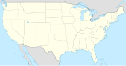
| Oversigtskort | |||
Cedar Rapids er en by i delstaten Iowa i Midtvesten i USA. Byen har et indbyggertal på 137.710 (2020)[2] indbyggere og et areal på 187 km2 . Den er hovedby i det amerikanske county Linn County.
Referencer
- ^ www.cedar-rapids.org, hentet 13. maj 2022 (fra Wikidata).
- ^ a b data.census.gov, hentet 21. september 2021.
USA's folketælling fra 2020, hentet 1. januar 2022 (fra Wikidata).
Eksterne henvisninger
- Officiel hjemmeside (engelsk)
| Spire |
Medier brugt på denne side
Forfatter/Opretter: NordNordWest, Licens: CC BY-SA 3.0
Location map of the United States ("lower 48")
(c) Lokal_Profil, CC BY-SA 2.5
Map showing Mainland USA ("lower 48") with a superimposed US flag.
(c) Iowahwyman, CC BY-SA 3.0
Skyline of Cedar Rapids, Iowa, looking northward from the 8th Avenue bridge. Photographed by User:Iowahwyman on June 17, 2007.
Forfatter/Opretter:
From the City's website, "To select a flag that best reflects the community, we asked residents to tell us what colors, shapes and symbols best represent Cedar Rapids. More than 200 residents sent design ideas.
Several volunteer designers used the input gathered from the community to create a series of concept flags. The concept flags were ranked and refined through feedback from members of the North American Vexillological Association and a local committee.
Cedar Rapids residents ranked four final designs to arrive at a new flag for the City of Cedar Rapids.", Licens: CC0The primary colors of the Cedar Rapids Flag are blue, green and white. Blue water forms a backdrop for the Cedar Rapids flag. It represents the Cedar River as it courses through Cedar Rapids, splitting at iconic Mays Island. A green field forms a rounded shape, emerging from either edge of the flag's hoisted end, and coming to a point just to the right of the flag's center. This shape depicts Mays Island and represents all of the wonderful green space and recreational areas of our city. A white arch forms a border between the blue water and green field. This shape represents the city’s homes, businesses and infrastructure, including long-term flood protection, which both interacts with and protects the community from the river. The rightward pointing direction of the arch indicates progress and symbolizes the city's promising future. A white, five-pointed star sits in the middle of the green field. The star represents the historic structures built on Mays Island. The five points illustrate the five seasons in the City's motto — City of Five Seasons — spring, summer, fall, winter, and extra time afforded to residents of Cedar Rapids to enjoy all of the other seasons and life.
Forfatter/Opretter: Alexrk2, Licens: CC BY 3.0
Grafik blev lavet med GeoTools. .


