Casa Grande
| Casa Grande | |
|---|---|
| Overblik | |
| Land | |
| Delstat | |
| County | Pinal County |
| Grundlagt | 1879 |
| Telefonkode | 520 |
| UN/LOCODE | USCGZ |
| Demografi | |
| Indbyggere | 53.658 (2020)[1] |
| Andet | |
| Tidszone | Mountain Time Zone |
| Højde m.o.h. | 426 m |
| Hjemmeside | www.casagrandeaz.gov |
| Oversigtskort | |
Casa Grande er en by, der ligger i Pinal County i delstaten Arizona i USA. Indbyggertallet for byen er 55.653 (2020).
Historie


Casa Grande blev grundlagt i 1879 som jernbanestation og er navngivet efter de forhistoriske ruiner, som ligger 32 km nordøst for byens forretningscentrum. Ruinerne er under National Park Services' forvaltning som National Monument. Ruinerne blev forladt omkring 1350 af Hohokam-indianerne, som forsvandt sporløst omkring 1450. Det menes, at Hohokam-indianerne havde bygget et astronomisk observatorium på dette sted. Ruinerne er dagligt åbne for besøgende.
Referencer
- ^ data.census.gov, hentet 1. januar 2022 (fra Wikidata).
Kilder
- Bobby Zlatevski (2001). I bil igennem Arizona. Søllested: Bobby's Korrespondance Service. ISBN 87-986396-1-7.
Eksterne henvisninger
| Spire |
Medier brugt på denne side
Forfatter/Opretter: NordNordWest, Licens: CC BY-SA 3.0
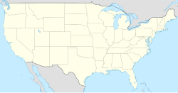
Location map of the United States ("lower 48")
(c) Lokal_Profil, CC BY-SA 2.5
Map showing Mainland USA ("lower 48") with a superimposed US flag.
Forfatter/Opretter: NordNordWest, Licens: CC BY-SA 3.0
Location map of Arizona, USA
(c) Marine 69-71 at en.wikipedia, CC BY-SA 3.0
The Casa Grande Union High School was built in 1920 and is located at 510 E. Florence Boulevard. The building now serves as the Casa Grande City Hall. The structure was listed in the National Register of Historic Places in 1986, reference #86000821.
ᎡᏩᏐᎾ ᎦᏓᏘ
Casa Grande Ruins
This map shows the incorporated areas and unincorporated areas in Pinal County, Arizona. Casa Grande is highlighted in red. Other incorporated cities are shown in gray, planning area borders for these cities and Indian reservation borders are shown as solid black lines. Map data is based on the following files as noted, all of which are .pdf files: *Pinal County 2008 Comprehensive Plan Amendments (.pdf) - For determining incorporated and Indian reservation boundaries. *CAAG Pinal Planning Commissioners Presentation (.pdf) - For determining planning area boundaries in Pinal County. *CAAG Population Estimates for Pinal County Places (.pdf) - For determining boundaries of unincorporated areas in Pinal County. Additional data for cities shown are based on individual files from each city's Website. (Please view the category page for links to these files.) I created this map in Inkscape. Please Note: This file replaces Image:Pinal County Incorporated areas Casa Grande highlighted.svg, which is now obsolete!


