Calicut
| Calicut | |
|---|---|
 | |
| Overblik | |
| Land | |
| Delstat | Kerala |
| Postnr. | 673001 |
| Demografi | |
| Indbyggere | 431.560 |
| - Areal | 177 km² |
| - Befolkningstæthed | 2.438 pr. km² |
| Andet | |
| Højde m.o.h. | 1 m |
| Hjemmeside | www.kozhikode.nic.in |
| Oversigtskort | |
Calicut | |
Calicut (Kozhikode eller Kalikut) er en by i Indien på vestkysten sydvest for Bangalore i den indiske delstat Kerala.
På en række sprog har kalkunen sit navn efter denne by, således på hollandsk kalkoen, på dansk og norsk kalkun, på svensk kalkon og på papiamento kalakuna.
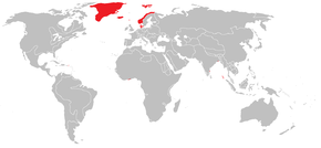
Calicut var i 1700-tallet hjemsted for et dansk faktori.
Eksterne henvisninger
| |||||||||||||||||||||||||||||||||||||||||||||||||||||||||
| Spire |
|
Medier brugt på denne side
(c) Uwe Dedering at tysk Wikipedia, CC BY-SA 3.0
Location map of India.
Equirectangular projection. Strechted by 106.0%. Geographic limits of the map:
- N: 37.5° N
- S: 5.0° N
- W: 67.0° E
- E: 99.0° E
Forfatter/Opretter: Sodacan, Licens: CC BY-SA 3.0
Royal Arms of King Frederick IV of Denmark and Norway, King from 1699 - 1730.
Forfatter/Opretter: Kasper Holl, Licens: CC BY-SA 3.0
Denmark-Norway and possessions in 1800. Other international borders represent the situation in the 1710s.
Forfatter/Opretter: Nmkuttiady, Licens: CC BY-SA 3.0
Mofussil Bus Stand (New Bus Stand) entrance on the Indira Gandhi Road (Mavoor Road), Calicut
Forfatter/Opretter: Vinayaraj, Licens: CC BY-SA 3.0
Kozhikode Mavoor Road Bus Stand, a distant view.


