Byer i Republikken Irland

Denne oversigt over de 100 største byer i Republikken Irland er baseret på Folketællingen i Irland 2016. Byer med city-status er anført med betegnelsen (city) efter bynavn.

Befolkningstallet er inklusive forstæder. Dette forklarer, hvorfor nogle af byerne strækker sig over to county (grevskaber).

Byer

(c) GrahamH, CC BY-SA 2.5
Irlands største by Dublin
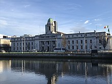
Nr. 2 Cork
Nr. 4 Galway
(c) tony quilty, CC BY-SA 2.0
Nr. 5 Waterford
Nr. 6 Drogheda
(c) Peter Gerken, CC BY-SA 2.0
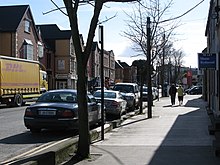
Nr. 7 Swords
Nr. 8, Dundalk
Nr. 9, Bray
(c) JP, CC BY-SA 2.0
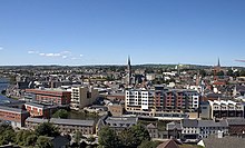
Nr. 10, Navan
(c) Andreas F. Borchert, CC BY-SA 4.0
Nr. 11, Kilkenny
Nr. 12, Ennis
(c) Jonathan Billinger, CC BY-SA 2.0
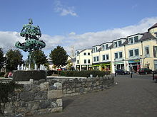
Nr. 13, Carlow
Rangering
2016
Ændring
siden 2011
ByområdeCountyBefolkning i 2016Ændring
siden 2011
1Uændret 0DublinCounty Dublin1,173,179[1]5.6%
2Uændret 0CorkCounty Cork208,669[2]5.1%
3Uændret 0LimerickCounty Limerick & County Clare94,192[3]3.0%
4Uændret 0GalwayCounty Galway79,934[4]4.1%
5Uændret 0WaterfordCounty Waterford & County Kilkenny53,504[5]3.9%
6Uændret 0DroghedaCounty Louth & County Meath40,956[6]6.2%
7Stigning 1SwordsCounty Fingal39,248[7]6.3%
8Fald 1DundalkCounty Louth39,004[8]3.1%
9Uændret 0BrayCounty Wicklow & County Dublin32,600[9]2.3%
10Uændret 0NavanCounty Meath30,173[10]5.7%
11Stigning 1KilkennyCounty Kilkenny26,512[11]8.6%
12Fald 1EnnisCounty Clare25,276[12]-0.3%
13Stigning 1CarlowCounty Carlow & County Laois24,272[13]5.4%
14Fald 1TraleeCounty Kerry23,691[14]-0.0%
15Uændret 0NewbridgeCounty Kildare22,742[15]5.5%
16Stigning 2Port LaoiseCounty Laois22,050[16]9.5%
17Stigning 4BalbrigganCounty Fingal21,722[17]8.8%
18Fald 2NaasCounty Kildare21,393[18]3.3%
19Fald 2AthloneCounty Westmeath & County Roscommon21,349[19]5.9%
20Fald 1MullingarCounty Westmeath20,928[20]4.1%
21Stigning 2CelbridgeCounty Kildare20,2883.8%
22Fald 2WexfordCounty Wexford20,1880.6%
23Fald 1LetterkennyCounty Donegal19,274-1.6%
24Uændret 0SligoCounty Sligo19,199-1.3%
25Stigning 1GreystonesCounty Wicklow18,1403.8%
26Fald 1ClonmelCounty Tipperary & County Waterford17,140-4.3%
27Uændret 0MalahideCounty Fingal16,5504.4%
28Stigning 1CarrigalineCounty Cork15,7706.7%
29Fald 1LeixlipCounty Kildare15,5040.3%
30Uændret 0TullamoreCounty Offaly14,6071.7%
31Stigning 2MaynoothCounty Kildare14,58516.6%
32Fald 1KillarneyCounty Kerry14,5042.0%
33Fald 1ArklowCounty Wicklow13,1631.2%
34Uændret 0CobhCounty Cork12,8003.7%
35Stigning 3AshbourneCounty Meath12,67911.7%
36Uændret 0MidletonCounty Cork12,4964.1%
37Uændret 0MallowCounty Cork12,4597.4%
38Fald 3CastlebarCounty Mayo12,068-2.0%
39Stigning 1Laytown-Bettystown-Mornington-DonacarneyCounty Meath11,8729.0%
40Stigning 1EnniscorthyCounty Wexford11,3815.0%
41Stigning 3CavanCounty Cavan10,9146.4%
42Uændret 0WicklowCounty Wicklow10,5842.2%
43Uændret 0TramoreCounty Waterford10,3810.5%
44Fald 5BallinaCounty Mayo10,171-8.3%
45Stigning 2SkerriesCounty Fingal10,0433.8%
46Stigning 2LongfordCounty Longford10,0084.2%
47Stigning 4RushCounty Fingal9,9437.7%
48Stigning 4GoreyCounty Wexford9,822[21]7.8%
49Fald 3ShannonCounty Clare9,7290.6%
50Fald 5AthyCounty Kildare9,677-2.5%
51Stigning 2RatoathCounty Meath9,5335.4%
52Fald 2PortmarnockCounty Fingal9,4661.9%
53Fald 4DungarvanCounty Waterford9,227-2.1%
54Stigning 1TrimCounty Meath9,19411.2%
55Fald 1NenaghCounty Tipperary8,9686.3%
56Uændret 0TuamCounty Galway8,7676.4%
57Stigning 1KildareCounty Kildare8,6346.0%
58Stigning 3PortarlingtonCounty Laois & County Offaly8,3687.4%
59Fald 2New RossCounty Wexford8,040-1.4%
60Uændret 0YoughalCounty Cork7,9632.2%
61Fald 2ThurlesCounty Tipperary7,9400.1%
62Stigning 1LuskCounty Fingal7,78610.9%
63Fald 1MonaghanCounty Monaghan7,6783.0%
64Stigning 3DonabateCounty Fingal7,4439.8%
65Fald 1EdenderryCounty Offaly7,3595.5%
66Stigning 2ClaneCounty Kildare7,2808.6%
67Fald 2DunboyneCounty Meath7,2724.5%
68Stigning 2BandonCounty Cork6,9574.8%
69Fald 3BuncranaCounty Donegal6,785-0.8%
70Fald 1BallinasloeCounty Galway & County Roscommon6,6620.0%
71Stigning 6Kinsealy-DrinanCounty Fingal6,64314.3%
72Uændret 0Newcastle WestCounty Limerick6,6194.6%
73Fald 2FermoyCounty Cork6,5851.5%
74Fald 1WestportCounty Mayo6,1982.2%
75Uændret 0KellsCounty Meath6,1354.2%
76Stigning 4KilcockCounty Kildare6,09310.1%
77Stigning 2RoscommonCounty Roscommon5,8763.2%
78Stigning 5SallinsCounty Kildare5,84910.7%
79Fald 1Passage WestCounty Cork5,8430.9%
80Fald 6Carrick-on-SuirCounty Tipperary & County Waterford5,771-2.7%
81Fald 5BirrCounty Offaly & County Tipperary5,741-1.3%
82Stigning 3LoughreaCounty Galway5,5569.8%
83Stigning 3BlessingtonCounty Wicklow5,52010.2%
84Fald 2RoscreaCounty Tipperary5,4460.8%
85Stigning 4KinsaleCounty Cork5,2817.9%
86Stigning 9CarrigtwohillCounty Cork5,08011.6%
87Stigning 1CarrickmacrossCounty Monaghan5,0322.2%
88Stigning 4OranmoreCounty Galway4,9904.0%
89Fald 6TipperaryCounty Tipperary4,979-6.2%
90Fald 3ArdeeCounty Louth4,9280.0%
91Fald 1Ballybofey-StranorlarCounty Donegal4,8520.0%
92Fald 1ListowelCounty Kerry4,820-0.2%
93Uændret 0MountmellickCounty Laois4,7770.9%
94Stigning 6TullowCounty Carlow4,67317.6%
95Fald 1ClonakiltyCounty Cork4,592-2.7%
96Stigning 5AthenryCounty Galway4,44512.5%
97Fald 1CashelCounty Tipperary4,4229.2%
98Stigning newRathcooleSouth Dublin4,35127.2%
99Stigning newMonasterevinCounty Kildare4,24614.4%
100Fald 4KilcooleCounty Wicklow4,2394.7%

Referencer

  1. ^ "Settlement Dublin City And Suburbs". Central Statistics Office. 2016. Arkiveret fra originalen 13. november 2018. Hentet 21. juli 2017.
  2. ^ "Settlement Cork City And Suburbs". Central Statistics Office. 2016. Arkiveret fra originalen 30. juli 2017. Hentet 21. juli 2017.
  3. ^ "Settlement Limerick City And Suburbs". Central Statistics Office. 2016. Arkiveret fra originalen 11. december 2018. Hentet 21. juli 2017.
  4. ^ "Settlement Galway City And Suburbs". Central Statistics Office. 2016. Arkiveret fra originalen 30. juli 2017. Hentet 21. juli 2017.
  5. ^ "Settlement Waterford City And Suburbs". Central Statistics Office. 2016. Arkiveret fra originalen 30. juli 2017. Hentet 21. juli 2017.
  6. ^ "Settlement Drogheda". Central Statistics Office. 2016. Arkiveret fra originalen 30. juli 2017. Hentet 24. juli 2017.
  7. ^ "Settlement Swords". Central Statistics Office. 2016. Arkiveret fra originalen 30. juli 2017. Hentet 24. juli 2017.
  8. ^ "Settlement Dundalk". Central Statistics Office. 2016. Arkiveret fra originalen 30. juli 2017. Hentet 24. juli 2017.
  9. ^ "Settlement Bray". Central Statistics Office. 2016. Arkiveret fra originalen 30. juli 2017. Hentet 24. juli 2017.
  10. ^ "Settlement Navan (An Uaimh)". Central Statistics Office. 2016. Arkiveret fra originalen 30. juli 2017. Hentet 24. juli 2017.
  11. ^ "Settlement Kilkenny". Central Statistics Office. 2016. Arkiveret fra originalen 10. august 2019. Hentet 29. juli 2017.
  12. ^ "Settlement Ennis". Central Statistics Office. 2016. Arkiveret fra originalen 30. juli 2017. Hentet 29. juli 2017.
  13. ^ "Settlement Carlow". Central Statistics Office. 2016. Arkiveret fra originalen 30. juli 2017. Hentet 29. juli 2017.
  14. ^ "Settlement Tralee". Central Statistics Office. 2016. Arkiveret fra originalen 30. juli 2017. Hentet 29. juli 2017.
  15. ^ "Settlement Droichead Nua (Newbridge)". Central Statistics Office. 2016. Arkiveret fra originalen 30. juli 2017. Hentet 29. juli 2017.
  16. ^ "Settlement Portlaoise (Formerly Maryborough)". Central Statistics Office. 2016. Arkiveret fra originalen 30. juli 2017. Hentet 29. juli 2017.
  17. ^ "Settlement Balbriggan". Central Statistics Office. 2016. Arkiveret fra originalen 30. juli 2017. Hentet 29. juli 2017.
  18. ^ "Settlement Naas". Central Statistics Office. 2016. Arkiveret fra originalen 30. juli 2017. Hentet 29. juli 2017.
  19. ^ "Settlement Athlone". Central Statistics Office. 2016. Arkiveret fra originalen 30. juli 2017. Hentet 29. juli 2017.
  20. ^ "Settlement Mullingar". Central Statistics Office. 2016. Arkiveret fra originalen 30. juli 2017. Hentet 29. juli 2017.
  21. ^ "Settlement Gorey". Central Statistics Office. 2016. Arkiveret fra originalen 28. maj 2018. Hentet 28. maj 2018.

Medier brugt på denne side

Straight Line Steady.svg
Straight Line Steady, intended for use in Template:Infobox Company. Use {{steady}} in wikipedia to make small line for steady profit. Self-made.
GPO Portico - Morning.jpg
(c) GrahamH, CC BY-SA 2.5
General Post Office, Dublin
Waterford city at night - geograph.org.uk - 1034017.jpg
(c) tony quilty, CC BY-SA 2.0
Waterford city at night Image of Waterford city at night taken from across the River Suir
Galway Harbour 2007.jpg
Galway Harbour 2007
Poolboy Bridge, Navan - geograph.org.uk - 412366.jpg
(c) JP, CC BY-SA 2.0
Poolboy Bridge, Navan Crosses the Blackwater immediately above its confluence with the Boyne. Carries the northerly N51 traffic flow towards Drogheda.
Drogheda2005.jpg
Forfatter/Opretter: The original uploader was SteveDurnin at engelsk Wikipedia., Licens: CC BY 2.5
Photographer: Stephen Durnin ©2007
Brayview.JPG
View of Bray from w:Bray Head
Liberty Tree Carlow.jpg
(c) Jonathan Billinger, CC BY-SA 2.0
The Liberty Tree and Carlow town centre.
Dkit1 1024x768.jpg
One of the photos we took for inclusion in the DkIT wallpaper pack, which can be downloaded freely at http://www.dkit.ie/downloads
Cork City Hall, February 2018.jpg
Forfatter/Opretter: Dylan, Licens: CC BY-SA 4.0
Cork City Hall
Ennis.jpg
Forfatter/Opretter: No machine-readable author provided. Bogman assumed (based on copyright claims)., Licens: CC BY-SA 2.5
View of Ennis County Clare, Danny Burke
North Street, Swords, Co. Dublin - geograph.org.uk - 381905.jpg
(c) Peter Gerken, CC BY-SA 2.0
North Street, Swords, Co. Dublin The Council Offices are at the bottom of this street.
Kilkenny View from Round Tower to St Mary Cathedral 2007 08 28.jpg
(c) Andreas F. Borchert, CC BY-SA 4.0

Kilkenny, County Kilkenny, Ireland


View from the round tower at St. Canice's Cathedral to St. Mary's Cathedral.