Brazos River
| Brazos River | |
| Texas | |
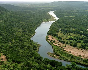
Brazos River nedenfor Possum Kingdom Lake (Palo Pinto County, Texas) | |
| Land | USA |
|---|---|
| Delstat | Texas |
| Udspring | Llano Estacado |
| - sted | Stonewall County, Texas |
| - højde | 453 moh |
| Udmunding | Mexicanske Golf |
| - sted | Brazoria County, Texas |
| - højde | 0 moh |
| - koord. | 28°52′33″N 95°22′42″V / 28.87583°N 95.37833°V [1] |
| Længde | 1.352 km |
| Afvandingsomr. | 116.000 km² |
| Vandføring | |
| - middel | 237,5 m³/s |
| - maks | 2.390 m³/s |
| - minimum | 076 m³/s |
 Brazos Rivers afvandingsområde | |
| Hjemmeside: Handbook of Texas: Brazos River | |
Brazos River kaldtes oprindelig Rio de los Brazos de Dios af spanske conquistadorer, og den er den 11. længste flod i USA. Den er 1.352 km lang, men med kildefloden Blackwater Draw i Curry County i New Mexico er den 2.060 km lang [2] til udmundningen i den Mexicanske Golf. Afvandingsområdeet dækker et areal på 116.000 km²[3] Floden løber i sydøstlig retning gennem Texas.
Se også
Eksterne kilder/henvisninger
- ^ "Brazos River". en:Geographic Names Information System, U.S. Geological Survey.
- ^ Kammerer, J.C. (1987): Largest Rivers in the United States, United States Geological Survey, besøgt 8. april 2009
- ^ Kenneth E. Hendrickson Jr.: «Brazos River», The Handbook of Texas Online, The General Libraries at the University of Texas at Austin og Texas State Historical Association, 15. februar 1999, besøgt 8. april 2009


|
Medier brugt på denne side
Forfatter/Opretter: Thad Roan from Littleton, CO, USA, http://www.Bridgepix.com, Licens: CC BY-SA 2.0
Railroad bridge over the Brazos River, Waco, Texas, USA
Forfatter/Opretter: HuecoBear, Licens: CC BY-SA 3.0
Brazos River below Possum Kingdom Lake, Palo Pinto County, Texas
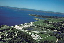
Aerial view of Whitney Lake and Dam on the Brazos River in Bosque and Hill Counties, Texas, USA. The river and lake form part of the border between the two counties. The U.S. Army Corps of Engineers constructed the dam in 1951 for flood control and water supply. View is to the north.
Forfatter/Opretter: No machine-readable author provided. Kmusser assumed (based on copyright claims)., Licens: CC BY-SA 2.5
This is a map of the Brazos River Watershed. I, Karl Musser, created it based on USGS data.


