Boulogne-Billancourt
| Boulogne-Billancourt – fransk kommune (commune) – | |||||
|---|---|---|---|---|---|
| |||||
 Kirke i Boulogne-Billancourt | |||||
| Land | |||||
| Region | |||||
| Departement | Hauts-de-Seine | ||||
| Arrondissement | Boulogne-Billancourt | ||||
| Kanton | hovedby for 3 kantoner | ||||
| Interkommunal enhed | Communauté d’agglomération Val de Seine | ||||
| Borgmester | Pierre-Christophe Baguet (fra 2008) | ||||
| Geografi | |||||
| Koordinater | 48°50′10″N 02°14′32″Ø / 48.83611°N 2.24222°Ø | ||||
| Højde (gns) | 33 m | ||||
| Areal | 6,17 km² | ||||
| Demografi | |||||
| Indbyggere | 116.220 | ||||
| Befolkningstæthed | 18.836 indb./km² | ||||
| Postnummer | 92100 | ||||
| INSEE-kode | 92012 | ||||
| Hjemmeside | www.boulognebillancourt.com | ||||
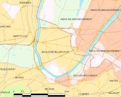 Kort over kommunen | |||||
Boulogne-Billancourt er en kommune og by i Frankrig beliggende sydvest for Paris som hovedby i departementet Hauts-de-Seine i regionen Île-de-France. Den har den største befolkning i departementet og er den næststørste kommune i storbyområdet Paris med en befolkning og befolkningstæthed, der svarer til et parisisk arondissement, hvilket den også nærmer sig mere og mere.
Demografi
| 1936 | 1954 | 1968 | 1975 | 1982 | 1990 | 1999 | 2005 |
|---|---|---|---|---|---|---|---|
| 97 379 | 93 998 | 109 008 | 103 578 | 102 582 | 101 743 | 106 367 | 109 400 |
| Tallene fra og med 1962 er uden dobbelttælling (Population sans doubles comptes) | |||||||
Uddannelse
Administration
Borgmestre
Borgmestre i Boulogne-Billancourt:
- 1919-1942 : André Morizet
- 1942-1944 : Robert Colmar
- 1944-1965 : Alphonse Le Gallo
- 1965-1971 : Albert Agogue
- 1971-1991 : Georges Gorse
- 1991-1995 : Paul Graziani
- 1995-2007 : Jean-Pierre Fourcade
- 2007-2008 : Pierre-Mathieu Duhamel
- 2008-2014 : Pierre-Christophe Baguet
- fra marts 2014 : Pierre-Christophe Baguet
Administrative forhold
Byen er opdelt i 3 kantoner:
- Boulogne-Billancourt-Nord-Est med 26 824 indbyggere
- Boulogne-Billancourt-Nord-Ouest med 35 520 indbyggere
- Boulogne-Billancourt-Sud med 44 023 indbyggere
Venskabsbyer
Boulogne-Billancourt har følgende venskabsbyer:
Siden 1955:
 Neukölln, Tyskland, det mest befolkede distrikt i Berlin med 350.000 indbyggere
 Anderlecht, Belgien, 100.000 indbyggere
 Hammersmith, Forenede Kongerige &
  Fulham, Forenede Kongerige
 Zaandam, Holland
Siden 1968:
 Marino, Italien, 30.000 indbyggere
 Pancevo, Serbien og Montenegro
Siden 1993:
Siden 1996:
 Raanana, Israel
Siden 2007:
- Guang'an (Folkerepublikken Kina)
Se også
| Søsterprojekter med yderligere information: |
| Spire Denne artikel om Frankrigs geografi er en spire som bør udbygges. Du er velkommen til at hjælpe Wikipedia ved at udvide den. |
Medier brugt på denne side
Cultural flag for the region Île-de-France in France, based on the flag of the kingdom of France (s.XIV-XV). It is neither recognized nor used by public authorities of Île-de-France.
Cultural flag for the region Île-de-France in France, based on the flag of the kingdom of France (s.XIV-XV). It is neither recognized nor used by public authorities of Île-de-France.
Flag of Serbia and Montenegro, was adopted on 27 April 1992, as flag of Federal Republic of Yugoslavia (1992-2003).
Flag of Serbia and Montenegro, was adopted on 27 April 1992, as flag of Federal Republic of Yugoslavia (1992-2003).
Map showing France with the ch flag.
Map showing France with the ch flag.
Forfatter/Opretter: Bledard92, Licens: CC BY-SA 3.0
Église Notre-Dame de Boulogne à Boulogne-Billancourt
Forfatter/Opretter:
|
Map data (c) OpenStreetMap contributors, CC-BY-SA  • Shape files infrastructure: railway, highways, water: all originally by OpenStreetMap contributors. Status december 2011 *note: shown commune boundaries are from OSM dump May 2012; at that time about 90% complete |
Map of French municipality Boulogne-Billancourt

