Bimini & Cat Cay
Koordinater: 25°44′N 79°15′V / 25.733°N 79.250°V
Bimini & Cat Cay i daglig tale blot Bimini er et distrikt og en ø i Bahamas[1].
Referencer
| Spire Denne artikel om geografi er en spire som bør udbygges. Du er velkommen til at hjælpe Wikipedia ved at udvide den. |
|
Medier brugt på denne side
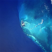
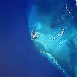
Bimini Island, Bahama Islands - June 1998
- The westernmost and closest to the United States mainland, the island of Bimini can be seen in this south-southwest-looking view. The two small islands that make up Bimini cover a total area of 9 sq. miles (23 sq. km). The waters surrounding Bimini are known for their excellent fishing. Bimini resembles an idyllic South Pacific atoll with a blue lagoon nearly enclosed by the two small islands. The island was named for the mythical island of Bimini, supposed site of the "Fountain of Youth", the quest for which led to the discovery of Florida in 1513 by Ponce De Leon.

