Biarritz
| Biarritz – fransk kommune (commune) – | |||||
|---|---|---|---|---|---|
| |||||
 Stranden og kasinoet i Biarritz | |||||
| Land | |||||
| Region | |||||
| Departement | Pyrénées-Atlantiques | ||||
| Arrondissement | Bayonne | ||||
| Geografi | |||||
| Koordinater | 43°29′N 1°39′V / 43.483°N 1.650°VKoordinater: 43°29′N 1°39′V / 43.483°N 1.650°V | ||||
| Højde (gns) | 40 m | ||||
| Areal | 11,66 km² | ||||
| Demografi | |||||
| Indbyggere | 25.903 | ||||
| Befolkningstæthed | 2.222 indb./km² | ||||
| Postnummer | 64200 | ||||
| INSEE-kode | 64122 | ||||
| Hjemmeside | www.biarritz.fr | ||||
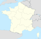
 Kort over kommunen | |||||
Biarritz er en by i det sydvestlige Frankrig. Den ligger ud til Biscayabugten i departementet Pyrénées-Atlantiques. Byen er en mondæn turistby, der blandt andet er populær blandt surfere
Eksterne henvisninger
| Spire Denne artikel om Frankrigs geografi er en spire som bør udbygges. Du er velkommen til at hjælpe Wikipedia ved at udvide den. |
|
Medier brugt på denne side
Map showing France with the ch flag.
Forfatter/Opretter:
|
Map data (c) OpenStreetMap contributors, CC-BY-SA • Shape files infrastructure: railway, highways, water: all originally by OpenStreetMap contributors. Status december 2011 *note: shown commune boundaries are from OSM dump May 2012; at that time about 90% complete |
Map commune FR insee code 64122.png
(c) I, Peter Potrowl, CC BY 3.0
Coat of arms of the French departement Pyrénées-Atlantiques (64)
Forfatter/Opretter: Pinpin, Licens: CC-BY-SA-3.0
Plages et casino de Biarritz, Pyrénées-Atlantiques (France)
Drapeau officiel de la Nouvelle-Aquitaine, inspirée du blason officiel.


