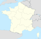
Aspremont
| Aspremont – fransk kommune (commune) – | |||||
|---|---|---|---|---|---|
| |||||
 Byens rådhus | |||||
| Land | |||||
| Region | |||||
| Departement | |||||
| Arrondissement | Nice | ||||
| Kanton | Levens | ||||
| Interkommunal enhed | Communauté urbaine Nice Côte d'Azur (NCA) | ||||
| Geografi | |||||
| Koordinater | 43°46′59.83″N 7°14′37.94″Ø / 43.7832861°N 7.2438722°ØKoordinater: 43°46′59.83″N 7°14′37.94″Ø / 43.7832861°N 7.2438722°Ø | ||||
| Højde (gns) | 499 m | ||||
| Areal | 9,44 km² | ||||
| Demografi | |||||
| Indbyggere | 2.195 | ||||
| Befolkningstæthed | 233 indb./km² | ||||
| Postnummer | 06790 | ||||
| INSEE-kode | 06006 | ||||
| Hjemmeside | www.auribeausursiagne.fr | ||||
 Kort over kommunen | |||||
Aspremont er en lille (2.034 indb) fransk kommune i den sydøstlige del af Frankrig. Indbyggerne, kaldes "les aspremontois". Den er placeret i departementet Alpes-Maritimes, nord for Nice.
Første gang historien nævner Aspremont er i slutningen af det 11. århundrede[1].
Geografi
Kommunen grænser op til følgende kommuner:
- I vest
- Colomars
- I nordvest
- Castagnier
- I øst
- Tourettes-Levens
- Falicon
- I syd
Klima
Klimaet er som resten af denne del af Frankrig præget af varme tørre somre, milde solrige vintre og våde ydersæsoner. Der kan dog, på grund af områdets topografi, være signifikante variationer, selv indenfor relativt korte afstande. Se artiklen om klimaet i departementet.
Demografi
| 1793 | 1800 | 1806 | 1821 | 1836 | 1846 | 1856 | 1861 |
|---|---|---|---|---|---|---|---|
| 1.275 | 1.291 | 1.507 | 1.535 | 1.590 | 1.797 | 1.863 | 1.680 |
| 1866 | 1872 | 1876 | 1881 | 1886 | 1891 | 1896 | 1901 |
| 1.713 | 1.565 | 513 | 727 | 512 | 711 | 615 | 579 |
| 1906 | 1911 | 1921 | 1926 | 1931 | 1936 | 1946 | 1954 |
| 611 | 591 | 510 | 424 | 437 | 327 | 220 | 311 |
| 1962 | 1968 | 1975 | 1982 | 1990 | 1999 | 2006 | |
| 465 | 698 | 771 | 1.150 | 1.496 | 1.853 | 2.034 |
Henvisninger
Fodnoter
- ^ "Aspremont". Arkiveret fra originalen 20. november 2006. Hentet 12. oktober 2008.
- ^ Aspremont – Notice Communale
|
Medier brugt på denne side
Forfatter/Opretter:
|
Map data (c) OpenStreetMap contributors, CC-BY-SA  • Shape files infrastructure: railway, highways, water: all originally by OpenStreetMap contributors. Status december 2011 *note: shown commune boundaries are from OSM dump May 2012; at that time about 90% complete |
Map commune FR insee code 06006.png
Forfatter/Opretter: Xarucoponce, Licens: CC BY-SA 4.0
Flag of the Region of Provence-Alpes-Côte d'Azur (France)
Forfatter/Opretter: HenrikKbh, Licens: CC BY-SA 3.0
Kommunen Aspremonts placering i departementet Alpes-Maritimes
Forfatter/Opretter: Ipankonin, Licens: CC BY-SA 3.0
Coat of arms of the counts of the County of Nice, and the current Alpes-Maritimes Department: Argent, an eagle displayed crowned gules standing upon three rocks vert issuing from the sea azure in base.


