Anadia
| Anadia | |||||
|---|---|---|---|---|---|
| |||||
 | |||||
| Overblik | |||||
| Land | |||||
| Grundlagt | 1514 | ||||
| Postnr. | 3780 | ||||
| Telefonkode | 231 | ||||
| Demografi | |||||
| Indbyggere | 29.150 (2011)[1] | ||||
| - Areal | 217 km² | ||||
| - Befolkningstæthed | 135 pr. km² | ||||
| Andet | |||||
| Tidszone | UTC±00:00 | ||||
| Højde m.o.h. | 29 m | ||||
| Hjemmeside | www.cm-anadia.pt | ||||
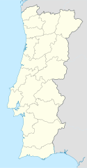
| Oversigtskort | |||||
Anadia er en portugisisk kommune og by. I 2011 havde den godt 29.000 indbyggere fordelt på 216 km².[2]
Referencer
- ^ BGRI - Página de download de informação geográfica, National Institute of Statistics, hentet 19. september 2018 (fra Wikidata).
- ^ Instituto Nacional de Estatística
Eksterne henvisninger
|
Medier brugt på denne side
Flag of Portugal, created by Columbano Bordalo Pinheiro (1857–1929), officially adopted by Portuguese government in June 30th 1911 (in use since about November 1910). Color shades matching the RGB values officially reccomended here. (PMS values should be used for direct ink or textile; CMYK for 4-color offset printing on paper; this is an image for screen display, RGB should be used.)
Forfatter/Opretter: No machine-readable author provided. Vitor107~commonswiki assumed (based on copyright claims)., Licens: CC BY 2.5
Buvete das termas da Curia - Anadia Fotografia de Vitor Oliveira, integrada na colecção com o endereço https://www.flickr.com/photos/vitor107/sets/
Source: https://www.flickr.com/photos/vitor107/59795967/Forfatter/Opretter: NordNordWest, Licens: CC BY-SA 3.0
Location map of Portugal


