Amol
| Amol آمل | |
|---|---|
 | |
| Overblik | |
| Land | |
| Postnr. | 46131–46391 |
| Telefonkode | 0121 |
| Demografi | |
| Indbyggere | 237.528 (2016)[1] |
| - Areal | 21,0 km² |
| - Befolkningstæthed | 11.311 pr. km² |
| Andet | |
| Tidszone | Iran Standard Tid |
| Højde m.o.h. | 76 m |
| Hjemmeside | www.amol.ir |
| Oversigtskort | |
Amol (persisk: آمل) er en by i shahrestanen Amol, Iran. Amol har 237.528 indbyggere (pr. 2016).
Kilder og henvisninger
- ^ www.amar.org.ir (fra Wikidata).
| Spire |
|
Medier brugt på denne side
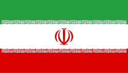
Flag of Iran. The tricolor flag was introduced in 1906, but after the Islamic Revolution of 1979 the Arabic words 'Allahu akbar' ('God is great'), written in the Kufic script of the Qur'an and repeated 22 times, were added to the red and green strips where they border the white central strip and in the middle is the emblem of Iran (which is a stylized Persian alphabet of the Arabic word Allah ("God")).
The official ISIRI standard (translation at FotW) gives two slightly different methods of construction for the flag: a compass-and-straightedge construction used for File:Flag of Iran (official).svg, and a "simplified" construction sheet with rational numbers used for this file.
Flag of Iran in the shape of the country.
Forfatter/Opretter: Uwe Dedering, Licens: CC BY-SA 3.0
Location map of Iran.
Equirectangular projection. Stretched by 118.0%. Geographic limits of the map:
* N: 40.0° N
* S: 24.5° N
* W: 43.5° E
* E: 64.0° E
Made with Natural Earth. Free vector and raster map data @ naturalearthdata.com.


