Alvingham
| Alvingham | |
|---|---|
(c) Dennis Wetherley, CC BY-SA 2.0 | |
| Overblik | |
| Land | |
| Demografi | |
| Indbyggere | 268 (2021)[1] |
| Andet | |
| Hjemmeside | www.alvinghamvillage.co.uk |
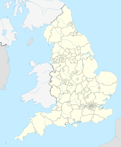
| Oversigtskort | |
(c) Karte: NordNordWest, Lizenz: Creative Commons by-sa-3.0 de Alvingham | |
Alvingham er en landsby og civil parish i East Lindsey-distriktet af Lincolnshire, England. Det ligger omkring 5 km nordøst for købstaden Louth.[2]
Landsbyen nævnes i Domesday Book som "Aluingeham", hvilket betyder "Hjemstæder for Ælfingas" (Ælfs stamme).[3] Gilbertinerordenens Alvingham Priory blev grundlagt her i 1141. Digteren og oversætteren Barnabe Googe arvede Alvingham Priorys tidligere jorde efter sin faders død i 1500-tallet.[4]
Alvingham Mill nævnes også i Domesday Book.[5]
Galleri
- Gallery
- Rester af en sluse
- (c) Simon Huguet, CC BY-SA 2.0Louth Canal
- Alvingham Mill
- (c) Dave Hitchborne, CC BY-SA 2.0St Adelwold
Referencer
- ^ Parish Profiles, Office for National Statistics, hentet 5. august 2024 (fra Wikidata).
- ^ AA Book of British Villages. Drive Publications Limited. 1980. s. 21. ISBN 9780340254875.
- ^ Mills, A.D., Oxford Dictionary of English Place-Names (2nd Edition), p. 9, OUP, 1997
- ^ Lyne, Raphael (2004). "Googe, Barnabe (1540–1594)". Oxford Dictionary of National Biography. Hentet 23. november 2013. (abonnement nødvendigt)
- ^ The Lincolnshire Village Book (reprint 1994 udgave). Newbury, Berkshire: Countryside Books. 1990. s. 13. ISBN 1 85306 077 1.
Eksterne henvisninger
| Spire |
Medier brugt på denne side
(c) Karte: NordNordWest, Lizenz: Creative Commons by-sa-3.0 de
Location map of England, United Kingdom
Forfatter/Opretter:
- jjllhlFlag_of_England.svg:
- England_location_map.svg: *United_Kingdom_location_map.svg: NordNordWest
- England_Regions_-_Blank.svg: Ch1902
- Northern_Ireland_location_map.svg: NordNordWest
- Europe_laea_location_map.svg: Alexrk2
- derivative work: Spischot (talk)
- derivative work: Fry1989 (talk) 20:50, 25 January 2011 (UTC)
Flag Map of England
(c) Dave Hitchborne, CC BY-SA 2.0
St Adelwold, Alvingham Two churches sit in the one churchyard, St Adelwolds Alvingham and St Marys, North Cockerington. St Adelwolds church, consecrated in 1131, had a thatched roof until 1820. No other church in England is dedicated to the Saxon Saint Adelwold who was Bishop of Lindisfarne.
Forfatter/Opretter: unknown, Licens:
(c) Dennis Wetherley, CC BY-SA 2.0
Alvingham churchyard. Alvingham contains two churches in the one churchyard, scarcely twenty yards apart. St Mary's with its stubby tower (in the background) was the parish church of North Cockerington. It is now in the care of the Churches Conservation Trust. St Adelwold's, (foreground) the parish church of Alvingham has the large stately tower.
(c) Simon Huguet, CC BY-SA 2.0
The Louth Canal from Highbridge The Louth Canal or Navigation was built between 1756 and 1777. It was taken over by the Great Northern Railway between 1849 and 1876 and trade declined steadily until it was temporarily closed during the 1914-18 war. The canal finally closed to navigation in 1924.


