Øer i Middelhavet

Dette er en liste over øer i Middelhavet, et indhav mellem Europa og Afrika, med Vestasien i øst og Atlanterhavet i vest.
Efter areal og befolkning
Listen består af kolonner som kan sorteres efter behov ved at klikke på sorteringssymbolet i kolonneoverskriften.
| Navn | Billede | Bihav | Land | Areal (km²) | Befolkning | Befolkningstæthed (pr. km²) | Hovedstad eller -by | |
|---|---|---|---|---|---|---|---|---|
| 1 | Sicilien |  | − | 25.460 | 5.010.000 | 196,78 | Palermo | |
| 2 | Sardinien | 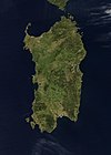 | − | 24.090 | 1.656.000 | 68,74 | Cagliari | |
| 3 | Cypern |  | − | 9.251 | 1.088.503[2] | 117,66 | Nicosia | |
| 4 | Korsika |  | − | 8.681 | 275.000 | 31,68 | Ajaccio | |
| 5 | Kreta | − | 8.312 | 624.000 | 75,07 | Heraklion | ||
| 6 | Evvia |  | − | 3.655 | 218.000 | 59,64 | Khalkis | |
| 7 | Mallorca |  | Baleariske Hav | 3.640 | 846.000 | 232,42 | Palma | |
| 8 | Lesbos |  | Ægæiske Hav | 1.630 | 90.000 | 55,21 | Mytilini | |
| 9 | Rhodos |  | Ægæiske Hav | 1.398 | 117.000 | 83,69 | Rhodos | |
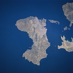
| 10 | Chios |  | Ægæiske Hav | 842 | 52.000 | 61,76 | Chios | |
| 11 | Kefallonia |  | Ioniske Hav | 781 | 37.000 | 47,38 | Argostoli | |
| 12 | Menorca |  | Baleariske Hav | 694 | 87.000 | 125,36 | Mahón | |
| 13 | Korfu | 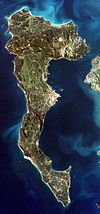 | Ioniske Hav | 592 | 108.000 | 182,43 | Korfu | |
| 14 | Ibiza |  | Baleariske Hav | 577 | 111.000 | 192,37 | Ibiza by | |
| 15 | Djerba |  | Gabèsbugten | 523 | 60.000 | 114,72 | Houmt Souk | |
| 16 | Limnos |  | Ægæiske Hav | 476 | 18.000 | 37,82 | Mirina | |
| 17 | Samos |  | Ægæiske Hav | 476 | 34.000 | 71,43 | Vathy | |
| 18 | Naxos |  | Ægæiske Hav | 428 | 18.000 | 42,06 | Naxos | |
| 19 | Zákynthos |  | Ioniske Hav | 406 | 39.000 | 96,06 | Zákynthos | |
| 20 | Cres |  | Adriaterhavet | 406 | 3.184 | 7,84 | Cres | |
| 21 | Krk |  | Adriaterhavet | 406 | 17.860 | 43,99 | Krk | |
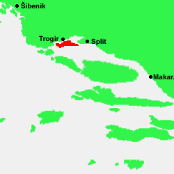
| 22 | Brač |  | Adriaterhavet | 395 | 14.031 | 35,52 | Supetar | |
| 23 | Andros |  | Ægæiske Hav | 380 | 10.000 | 26,32 | Andros | |
| 24 | Thassos |  | Ægæiske Hav | 379 | 13.765 | 36,32 | Thassos | |
| 25 | Lefkas |  | Ioniske Hav | 303 | 20.751 | 68,49 | Lefkas | |
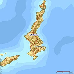
| 26 | Kárpathos |  | Ægæiske Hav | 301 | 6.565 | 21,81 | Pigadia | |
| 27 | Hvar |  | Adriaterhavet | 300 | 11.103 | 37,01 | Hvar | |
| 28 | Kos |  | Ægæiske Hav | 290 | 31.000 | 106,90 | Kos | |
| 29 | Pag |  | Adriaterhavet | 285 | 8.398 | 29,47 | Pag | |
| 30 | Gökçeada |  | Ægæiske Hav | 279 | 8.894 | 31,88 | Gökçeada | |
| 31 | Kithira |  | Ioniske Hav | 278 | 3.354 | 12,06 | Kithira | |
| 32 | Korčula |  | Adriaterhavet | 276 | 16.182 | 58,63 | Korčula | |
| 33 | Ikaria | (c) User: Bgabel at wikivoyage shared, CC BY-SA 3.0 | Ægæiske Hav | 255 | 8.312 | 32,60 | Agios Kirykos | |
| 34 | Malta |  | − | 246 | 373.000[3] | 1516,26 | Valletta | |
| 35 | Elba |  | Tyrrhenske hav | 224 | 31.572 | 140,95 | Portoferraio | |
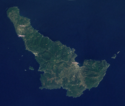
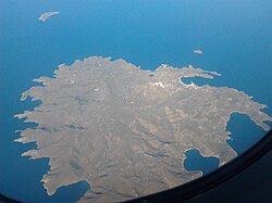
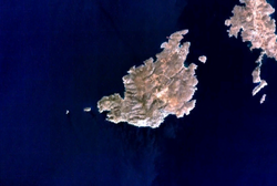
| 36 | Skíros |  | Ægæiske Hav | 209 | 2.602 | 12,45 | Skíros | |
| 37 | Paros |  | Ægæiske Hav | 196 | 12.853 | 65,58 | Parikia | |
| 38 | Tinos |  | Ægæiske Hav | 194 | 8.574 | 44,20 | Tinos | |
| 39 | Samotrake |  | Ægæiske Hav | 178 | 2.723 | 15,30 | Samotrake | |
| 40 | Milos |  | Ægæiske Hav | 160 | 4.771 | 29,82 | Plaka | |
| 41 | Kéa |  | Ægæiske Hav | 129 | 2.417 | 18,74 | Ioulis | |
| 42 | Amorgos | (c) User: Bgabel at wikivoyage shared, CC BY-SA 3.0 | Ægæiske Hav | 121 | 1.859 | 15,36 | Amorgos | |
| 43 | Marmara |  | Marmarahavet | 117 | − | − | Marmara | |
| 44 | Dugi Otok | (c) User: Gobbler at wikivoyage shared, CC BY-SA 2.0 | Adriaterhavet | 114 | 1.772 | 15,54 | Sali | |
| 45 | Kalymnos | Ægæiske Hav | 111 | 16.237 | 146,28 | Pothia | ||
| 46 | Chergui | Gabèsbugten | 110 | − | − | Remla | ||
| 47 | Sant'Antioco | − | 109 | 11.730 | 107,61 | Sant'Antioco | ||
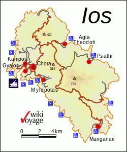
| 48 | Ios | (c) User: Bgabel at wikivoyage shared, CC BY-SA 3.0 | Ægæiske Hav | 109 | 1.838 | 16,86 | Ios | |
| 49 | Mljet |  | Adriaterhavet | 100 | 1.111 | 11,11 | Babino Polje | |
| 50 | Kythnos | 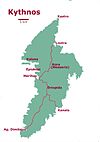 | Ægæiske Hav | 100 | 1.608 | 16,08 | Kythnos | |
| 51 | Astipálea |  | Ægæiske Hav | 97 | 1.238 | 16,89 | Astipálea | |
| 52 | Ithaka |  | Ioniske Hav | 96 | 3.084 | 32,13 | Vathy | |
| 53 | Skópelos |  | Ægæiske Hav | 95,5 | 4.696 | 49,17 | Skópelos | |
| 54 | Salamis |  | Saroniske Bugt | 95 | 38.022 | 400,23 | Salamina | |
| 55 | Rab |  | Adriaterhavet | 91 | 9.480 | 104,18 | Rab | |
| 56 | Vis |  | Adriaterhavet | 90 | 3.617 | 40,19 | Vis | |
| 57 | Mykonos | (c) User: Bgabel at wikivoyage shared, CC BY-SA 3.0 | Ægæiske Hav | 86 | 9.320 | 108,37 | Mykonos | |
| 58 | Syros |  | Ægæiske Hav | 84 | 19.782 | 235,50 | Ermoupoli | |
| 59 | Égina |  | Saroniske Bugt | 83 | 13.552 | 163,28 | Égina | |
| 60 | Formentera |  | Baleariske Hav | 83 | 7.461 | 89,89 | Sant Francesc Xavier | |
| 61 | Pantelleria | (c) User: Mediterranean.web at wikivoyage shared, CC BY-SA 3.0 | − | 83 | 7.729 | 93,12 | Pantelleria | |
| 62 | Santorini |  | Ægæiske Hav | 76 | 13.402 | 176,34 | Fira | |
| 63 | Lošinj | Adriaterhavet | 75 | 7.771 | 103,61 | Mali Lošinj | ||
| 64 | Serifos |  | Ægæiske Hav | 73 | 1.414 | 19,37 | Serifos | |
| 65 | Sifnos |  | Ægæiske Hav | 73 | 2.442 | 33,45 | Apollonia | |
| 66 | Gharbi | Gabèsbugten | 69 | − | − | Mellita | ||
| 67 | Gozo |  | − | 67 | 31.053 | 463,48 | Victoria | |
| 68 | Kasos | Ægæiske Hav | 66 | 990 | 15,0 | Fry | ||
| 69 | Alónissos | Ægæiske Hav | 64 | 2.700 | 42,19 | Patitiri | ||
| 70 | Tilos |  | Ægæiske Hav | 63 | 533 | 8,46 | Megálo Chorió | |
| 71 | Pašman | Adriaterhavet | 63 | 2.711 | 43,03 | Pašman | ||
| 72 | Šolta |  | Adriaterhavet | 59 | 1.479 | 25,07 | Grohote | |
| 73 | Simi | Ægæiske Hav | 58 | 2.606 | 44,93 | Simi | ||
| 74 | Leros | Ægæiske Hav | 53 | 8.207 | 154,85 | Agia Marina | ||
| 75 | San Pietro | − | 51 | 6.444 | 126,35 | Carloforte | ||
| 76 | Asinara | 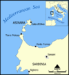 | − | 51 | 1 | 0,020 | Cala d' Oliva | |
| 77 | Hydra | Ægæiske Hav | 50 | 2.719 | 54,38 | Hydra | ||
| 78 | Ugljan | Adriaterhavet | 50 | 6.182 | 123,64 | Preko | ||
| 79 | Skiathos |  | Ægæiske Hav | 48 | 6.160 | 128,33 | Skiathos | |
| 80 | Lastovo | Adriaterhavet | 47 | 835 | 17,77 | Lastovo | ||
| 81 | Ischia |  | Tyrrhenske hav | 46 | 60.335 | 1311,63 | Ischia | |
| 82 | Agios Efstratios | Ægæiske Hav | 43 | 371 | 8,63 | Agios Efstratios | ||
| 83 | Nissiros |  | Ægæiske Hav | 41 | 948 | 23,12 | Mandraki | |
| 84 | Sikinos | Ægæiske Hav | 41 | 238 | 5,80 | Sikinos | ||
| 85 | Psara | Ægæiske Hav | 40 | 422 | 10,55 | Psara | ||
| 86 | Anafi | (c) User: Bgabel at wikivoyage shared, CC BY-SA 3.0 | Ægæiske Hav | 38 | 273 | 7,38 | Anafi | |
| 87 | Lipari |  | Tyrrhenske hav | 37 | 10.763 | 290,89 | Lipari | |
| 88 | Bozcaada |  | Ægæiske Hav | 36 | 2.427 | 67,42 | Bozcaada | |
| 89 | Kimolos |  | Ægæiske Hav | 36 | 769 | 21,36 | Kimolos | |
| 90 | Antiparos |  | Ægæiske Hav | 35 | 1.037 | 29,63 | Antiparos | |
| 91 | Patmos | (c) User: Bgabel at wikivoyage shared, CC BY-SA 3.0 | Ægæiske Hav | 35 | 2.984 | 85,26 | Patmos | |
| 92 | Kornat | Adriaterhavet | 32 | 7 | 0,22 | − | ||
| 93 | Folegandros |  | Ægæiske Hav | 32 | 667 | 20,84 | Folegandros | |
| 94 | Fourni |  | Ægæiske Hav | 30 | 1.326 | 44,2 | Fourni | |
| 95 | Gavdos |  | − | 29,6 | 98 | 3,31 | Kastri | |
| 96 | Ciovo |  | Adriaterhavet | 28,8 | 4.455 | 154,69 | Okrug Gornji | |
| 97 | Halki | Ægæiske Hav | 28,1 | 313 | 11,14 | Halki | ||
| 98 | Salina |  | Tyrrhenske hav | 26,8 | 2.300 | 85,82 | − | |
| 99 | Olib | Adriaterhavet | 26,1 | 147 | 5,63 | Olib | ||
| 100 | Uzunada | Ægæiske Hav | 25,4 | − | − | − | ||
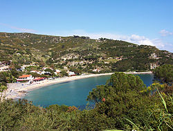
| 101 | Paxi | Ioniske Hav | 25,3 | 2.253 | 89,05 | Gaios | ||
| 102 | Kalamos | Ioniske Hav | 25 | 543 | 21,72 | Kalamos | ||
| 103 | Kyra Panagia | Ægæiske Hav | 25 | 10 | 0,40 | − | ||
| 104 | Giglio |  | Tyrrhenske hav | 23,8 | 1.458 | 61,26 | − | |
| 105 | Cunda (Alibey) | Ægæiske Hav | 23,4 | − | − | − | ||
| 106 | Poros |  | Saroniske Bugt | 22,9 | 4.348 | 189,87 | Poros | |
| 107 | Molat |  | Adriaterhavet | 22,8 | 207 | 9,08 | Molat | |
| 108 | Vir |  | Adriaterhavet | 22,4 | 1.608 | 71,79 | Vir | |
| 109 | Spetses | Ægæiske Hav | 22,2 | 3.908 | 176,04 | Spetses | ||
| 110 | Paşalimanı | Marmarahavet | 21,4 | − | − | Harmanli | ||
| 111 | Saria |  | Ægæiske Hav | 21,1 | 22 | 1,04 | − | |
| 112 | Vulcano | Tyrrhenske hav | 20,9 | 715 | 34,21 | Vulcano | ||
| 113 | Avsa |  | Marmarahavet | 20,6 | − | − | Avsa | |
| 114 | Antikythera | Ægæiske Hav | 20,4 | 44 | 2,16 | Potamós | ||
| 115 | Lampedusa |  | − | 20,2 | 4.500 | 222,77 | Lampedusa e Linosa | |
| 116 | La Maddalena | − | 20,1 | 11.902 | 592,14 | La Maddalena | ||
| 117 | Meganisi | Ioniske Hav | 20 | 1.090 | 54,50 | Katomeri | ||
| 118 | Favignana | Tyrrhenske hav | 19 | 4.383 | 230,68 | Favignana | ||
| 119 | Capraia | (c) I, Mai-Sachme, CC BY-SA 3.0 | Liguriske Hav | 19 | 410 | 21,58 | Capraia | |
| 120 | Elafonisos | Ioniske Hav | 19 | 745 | 39,21 | Elafonisos | ||
| 121 | Murter | Adriaterhavet | 18,6 | 5.192 | 279,14 | Murter | ||
| 122 | Makronisos |  | Ægæiske Hav | 18,3 | − | − | − | |
| 123 | Iraklia |  | Ægæiske Hav | 17,6 | 151 | 8,58 | Iraklia | |
| 124 | Iž | Adriaterhavet | 17,6 | 557 | 31,65 | Iž Veli | ||
| 125 | Gyaros | Ægæiske Hav | 17,3 | − | − | − | ||
| 126 | Megalonisos Petalion |  | Ægæiske Hav | 17,2 | − | − | − | |
| 127 | Polyaigos |  | Ægæiske Hav | 17,2 | − | − | − | |
| 128 | Unije | Adriaterhavet | 16,9 | 90 | 5,33 | Unije | ||
| 129 | Lipsi | Ægæiske Hav | 16 | 698 | 43,63 | Leipsoi | ||
| 130 | Šipan | Adriaterhavet | 15,8 | 436 | 27,59 | Šipanska Luka | ||
| 131 | Caprera | − | 15,7 | − | − | − | ||
| 132 | Cabrera |  | Baleariske Hav | 15,7 | − | − | − | |
| 133 | Keros |  | Ægæiske Hav | 15,2 | − | − | − | |
| 134 | Žirje |  | Adriaterhavet | 15,1 | 124 | 8,21 | Žirje | |
| 135 | Sestrunj |  | Adriaterhavet | 15 | 48 | 3,20 | Sestrunj | |
| 136 | Silba |  | Adriaterhavet | 15 | 265 | 17,67 | Silba | |
| 137 | Žut | Adriaterhavet | 14,8 | − | − | − | ||
| 138 | Pserimos |  | Ægæiske Hav | 14,8 | 130 | 8,78 | Pserimos | |
| 139 | Inousses | Ægæiske Hav | 14,4 | 999 | 69,38 | Inousses | ||
| 140 | Peristera | Ægæiske Hav | 14,2 | 5 | 0,35 | − | ||
| 141 | Rinia | Ægæiske Hav | 13,7 | − | − | − | ||
| 142 | Agathonisi | Ægæiske Hav | 13,6 | 158 | 11,62 | Megálo Chorió | ||
| 143 | Donoussa | Ægæiske Hav | 13,6 | 163 | 11,99 | Donoussa (Stavros) | ||
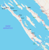
| 144 | Prvic (Krk) | (c) Roberta F., CC BY-SA 3.0 | Adriaterhavet | 13,5 | − | − | − | |
| 145 | Stromboli |  | Tyrrhenske hav | 12,6 | 572 | 45,40 | San Vincenzo | |
| 146 | Dokos | Ægæiske Hav | 12,5 | 43 | 3,44 | Dokos | ||
| 147 | Porquerolles |  | − | 12,5 | 200 | 16,0 | − | |
| 148 | Schiza | Ioniske Hav | 12,3 | 2 | 0,16 | − | ||
| 149 | Drvenik Veliki |  | Adriaterhavet | 12,1 | 168 | 13,88 | Drvenik Veliki | |
| 150 | Marettimo | − | 12 | 819 | 68,25 | Marettimo | ||
| 151 | Angistri |  | Ægæiske Hav | 12 | 920 | 76,67 | Milos (Megalohori) | |
| 152 | Dia |  | − | 11,8 | − | − | − | |
| 153 | Gioura | Ægæiske Hav | 11,1 | − | − | − | ||
| 154 | Capri |  | Tyrrhenske hav | 10,4 | 12.200 | 1173,08 | Capri | |
| 155 | Montecristo |  | Tyrrhenske hav | 10,4 | 2 | 0,19 | − | |
| 156 | Pianosa |  | Tyrrhenske hav | 10,3 | 10 | 0,97 | − | |
| 157 | Othonoi |  | Ioniske Hav | 10,1 | 631 | 62,48 | Othonoi | |
| 158 | Thymaina | Ægæiske Hav | 10,1 | 151 | 14,95 | Thymaina | ||
| 159 | Imrali | Marmarahavet | 10 | − | − | − |
Efter land
Albanien

- Sazan
- Kunë
- Ksamiløerne
- Franz Josef-øen
- Zvërnecøerne
- Tongoøen
- Stil

Frankrig
- Korsika
- Lavezziøerne
- Friouløerne
- Lerinsøerne
Grækenland


- Nordægæiske Øer
- Saroniske Øer


- Ioniske Øer
Italien


- Pontinske øer
- Sardinien
- Asinara
- Grottaferrata
- La Maddalena
- Caprera
- Spargi
- Budelli
- Razzoli
- Santa Maria
- Santo Stefano
- Sant'Antioco
- San Pietro
- Tavolara

- Tremitiøerne
- Caprara
- Cretaccio
- Pianosa (di Tremiti)
- San Domino
- San Nicola

- Toscanske arkipelag
- Venetianske laguneøer
- Burano
- Lido
- Murano
- Pellestrina
- San Lazzaro degli Armeni
- Sant'Andrea
- Torcello
Kroatien
- Brijuni
- 14 øer

- Brusnik
- Čiovo
- Cres
- Drvenik Mali
- Drvenik Veli
- Dugi Otok
- Elafitiøerne
- Goli Otok
- Hvar
- Iž
- Ilovik
- Ist
- Kaprije
- Koločep
- Korčula
- Kornati
- 152 øer i Kornati-arkipelaget


- Krapanj
- Krk
- Lastovo
- Lokrum
- Lošinj
- Lopud
- Male Srakane
- Mljet
- Molat
- Murter
- Olib
- Pašman
- Pag
- Palagruža
- Plavnik
- Premuda
- Prvić
- Rab
- Rava
- Rivanj
- Sestrunj
- Silba
- Skarda
- Susak
- Svetac
Malta

Montenegro
- Ada Bojana

- Katič
- Stari Ulcinj
- Sveta Neđelja
- Sveti Nikola
- Sveti Stefan
I Kotorbugten:
- Gospa od Škrpjela
- Mamula
- Miholjska prevlaka
- Sveti Đorđe
- Sveti Marko
- Øen for Vor Frue af nåde
Spanien
- Alborán

- Baleariske Øer
- Cabrera-øgruppen
- Pityusiske øer
- Espalmador
- Es Vedrà
- Formentera
- Ibiza
- Columbretes-øerne
- Formigues
- Islas Chafarinas
- Isla del Congreso
- Isla del Rey
- Isla Isabel II
- Medes
- Peñón de Alhucemas
- Tabarca

Syrien
- Arwad
Tunesien
- Djerba
- Kerkennaøerne
- Chergui
- Gharbi
- Galite-øerne
- Zembra
Tyrkiet


- De tyrkiske ægæiske øer
- Baba Ada
- Bozcaada
- Büyükada
- Çatalada
- Fener Ada
- Gemiler Adası
- Gökçeada
- Hayırsız Ada
- Heybeliada
- İnce Ada
- İncir Ada
- Kara Ada
- Kargı Adası
- Köçek Adası
- Metalik Ada
- Orak Ada
- Salih Ada
- Yalıkavak
- Yassı Ada
- Yılancık Ada
- İkiz Adalar
- Pırasa adası
- Iç Ada
- Kiremitøerne
- Küçük Tavşan Adası
- Çavuş adası
- Kucukbu

- Andre tyrkiske middelhavsøer
- Kekova
- Sıçan Adası
Omstridte øer
- Imia/Kardak (Grækenland/Tyrkiet)
- Persilleøen (Marokko/Spanien)
Politisk delt ø

- Cypern
- Republikken Cypern
- Akrotiri og Dhekelia (to militærbaseområder under britisk suverænitet)
- Den Tyrkiske Republik Nordcypern (en de facto stat som kun er anerkendt af Tyrkiet, og som er skilt fra Republikken Cypern af en FN-kontrolleret bufferzone)
Fodnoter
- ^ Den Tyrkiske Republik Nordcypern kontrollerer omkring en tredjedel af øen Cypern, og republikken anerkendes som en selvstændig stat af kun Tyrkiet. Republikken Cypern gør krav på hele øen.
- ^ Samlet folketal for Republikken Cypern (803.147) og Nordcypern (285.356)
- ^ Folketallet inkluderer ikke øen Gozo, som tilhører Malta og har 31.000 indbyggere.
 Der er for få eller ingen kildehenvisninger i denne artikel, hvilket er et problem. Du kan hjælpe ved at angive troværdige kilder til de påstande, som fremføres i artiklen.
Medier brugt på denne side
Det er let at give dette billede en kant
Forfatter/Opretter: Arnoldius, Licens: CC BY-SA 3.0
Othonoi ist eine kleine griechische Insel nordwestlich von Korfu. Ansicht von Südost
Forfatter/Opretter: Eric Gaba (original author), User:Historicair (locator map), Ferengi (cropping, removal of labels), Licens: CC BY-SA 3.0
Map of Naxos Island
(c) User: Bgabel at wikivoyage shared, CC BY-SA 3.0
Lage der Insel Patmos im Dodekanes
Illa de Pontikonisi
Forfatter/Opretter: Olivier Brunet, Licens: CC BY-SA 3.0
Vue aérienne de l'ile de Pianosa, dans l'archipel Toscan en Italie
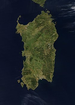
Credit Jeff Schmaltz, MODIS Rapid Response Team, NASA/GSFC The island of Sardinia sits between the Mediterranean Sea to the south and west and the Tyrrhenian Sea to the east. To its immediate north is the island of Corsica, which is a part of France. To the east of Sardinia is the middle of the Italian peninsula (not shown). Sardinia glows here with the green blush of spring.
Sardinia has had a tumultuous history. Starting in ancient times, the island was occupied by Phoenicians, Carthaginians, and Romans; thereafter it was controlled by Vandals, Byzantines, and a long string of rulers of Italian city-states. In the late 15th century, Sardinia came under the control of Spain, then in the early 18th century was passed to the Austrians. It briefly fell to Spanish occupation in 1717, but by 1720 was given over again to the control of Italian rule. This true-color Aqua MODIS image was acquired on April 27, 2003.Island of Croatia - Croatia - Korcula.PNG
Map of Gőkceada
Tunisia, Sicily, Sardinia, the south of Italy and Malta
Forfatter/Opretter: No machine-readable author provided. Duk assumed (based on copyright claims)., Licens: CC BY-SA 3.0
source:me, Based on various maps, made with autotrace (centerline switch for tracing roads) and inkscape (with built-in raster to vector converter).
Greek Island Skyros from space
Forfatter/Opretter: Ita01, Licens: CC BY-SA 3.0
veduta di Palmarola da Ponza al tramonto
(c) Ra Boe / Wikipedia, CC BY-SA 3.0 de
Blick auf San Nicola
Forfatter/Opretter: Dimorsitanos, Licens: CC BY-SA 3.0 gr
Map of Antiparos island, Greece
Satelite image of Zirje island, Croatia.
Forfatter/Opretter: Jacques Descloitres, MODIS Rapid Response Team, NASA/GSFC, Licens: CC0
Kos Island
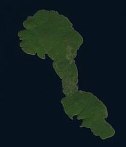
Greek Island Angistri from space
Greek Island Andros from space
Forfatter/Opretter: http://www.planiglobe.com/omc_set.html, Licens: CC BY-SA 2.5
Map of Karpathos
Satellite image of the island of Euboea (Greece)
Forfatter/Opretter:
- Aegina_general_map-de.svg: Uwe Dedering
- derivative work: Uwe Dedering (talk)
Map of the island Aegina, Greece. Equirectangular projection. Strechted by 125.0%. Geographic limits of the map: * N: 37.8° N * S: 37.65° N * W: 23.4° E * E: 23.6° E Relief: SRTM3 V2 for land and ETOPO1 for water. Coastline and streets: OSM Names and locations: GeoNames
Forfatter/Opretter: Luca Siragusa, Licens: CC BY 2.0
Lampedusa island, Italy, part of the Pelagie Islands located in the central part of the Mediterranean Sea between Europe and Africa.
Satellite picture of Cabrera Archipelago National Park — in the Balearic Islands, Spain.
Forfatter/Opretter: it:Utente:Civvi, Licens: CC BY 2.5
Isola d'Elba - Spiaggia di Cavoli
Satellite image of Skopelos, Greek island in the Aegean sea
Forfatter/Opretter: No machine-readable author provided. Ivana51~commonswiki assumed (based on copyright claims)., Licens: CC BY-SA 3.0
Forfatter/Opretter: Nino Verde, Licens: CC BY-SA 3.0
Aphrodite's Rock (Petra tou Romiou) in Cyprus.
Forfatter/Opretter: Erik1980, Licens: CC BY-SA 3.0
The Blue Lagoon and Cominotto island
Satellite image of Sicily
This true-color scene of a smoke plume streaming eastward from snow-capped Mount Etna was acquired on April 7, 2002, by the Moderate-resolution Imaging Spectroradiometer (MODIS), aboard NASA's Terra satellite. Mount Etna, towering above Catania, Sicily's second largest city, has one of the world's longest documented records of historical volcanism, dating back to 1500 BC. Historical lava flows cover much of the surface of this massive basaltic stratovolcano, the highest and most voluminous in Italy.Forfatter/Opretter: kallerna, Licens: CC BY-SA 3.0
Monastery near Zia town on Kos island, Greece.
Forfatter/Opretter:
The original uploader was Frente at tysk Wikipedia.
Luftbild der Insel Dia
Island of Croatia Croatia - Vir.PNG
Ischia Island
Forfatter/Opretter: Bourrichon - fr:Bourrichon, Licens: CC BY-SA 3.0
Topographic and administrative map in French of Porquerolles
Map of the island of w:Astypalaia (Stampalia) in Greece, created in 1597 by the Venetian Giacomo (Jacomo) Franco (1550-1620) for his book Viaggio da Venetia a Constantinopoli per Mare.
Sattelite image of Majorca
(c) User: Bgabel at wikivoyage shared, CC BY-SA 3.0
Karte der Kykladen-Insel Ios, Umriss von OSM
Forfatter/Opretter: C messier, Licens: CC BY-SA 3.0
The island of Serifos as seen from above.
(c) User: Bgabel at wikivoyage shared, CC BY-SA 3.0
Karte der griechischen Insel Ikaria
Chios, or Khios, Island, Greece Located in the eastern Aegean Sea just off the coast of western Turkey, the Greek island of Chios can be seen in this near-nadir view. Chios Island is 30 miles (48 km) long and 8 to 15 miles (13 to 24 km) wide and covers an area of 350 sq. miles (905 sq. km). The island is hilly, scenic, and fertile with a good climate. Chios produces olives, figs, and mastic and has marble quarries, lignite deposits, and sulfur springs. Chios is noted in antiquity for its claims as Homer's birthplace and for its school of epic poets, the Homeridae. The land visible at the right center and top right is part of the country of Turkey.
(c) Phelim123 at engelsk Wikipedia, CC BY-SA 3.0
View of Myrina beach, Lemnos in Lesbos prefecture, Greece.
Island of Croatia - Croatia - Brac.PNG
Photographie de Kéa et Makronissos depuis la Station Spatiale Internationale - Résolution supérieure.
Forfatter/Opretter: Allumeur, Licens: CC BY 3.0
Montecristo isle as it's seen from its north side.
Visible colour satellite image of Rhodes.
Forfatter/Opretter: Nedim Ardoğa, Licens: CC BY-SA 3.0
Citadel in Bozcaada island in Çanakkale Province
Forfatter/Opretter: Cédric Boissière à partir du fond de carte / from Blank map of the Cyclades, Greece de/of Sting, Licens: CC BY 3.0
Villes et villages principaux de Paros / Principal towns and villages of Paros
GR Kythira.PNG (Greek island)
Samos City
(c) User: Bgabel at wikivoyage shared, CC BY-SA 3.0
Karte der Kykladeninsel Mykonos
Forfatter/Opretter: Toksave, Licens: CC BY-SA 3.0
Marmara Island, Turkey (Marmara Sea)
Forfatter/Opretter: Toksave, Licens: CC BY-SA 3.0
Avşa Island (also known as Türkeli island), Turkey (located in the Marmara Sea)
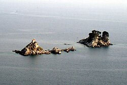
Islands near Petrovac (Montenegro, Adriatic Sea).
Lesbos Island, Greece - September/October 1995
Greek Island Moni from space
Forfatter/Opretter: Andres rus, Licens: CC BY-SA 3.0
Prvic Luka. Island of Prvic. Croatia, near Sibenik
Forfatter/Opretter: © OpenStreetMap contributors, cropped by myself, Licens: CC BY-SA 2.0
Map of Pakleni otoci and Hvar
Forfatter/Opretter: Oyoyoy, Licens: CC BY-SA 3.0
Saria Island (Greek: Σαρία) is an island in Greece, along the northern edge of Karpathos, separated from it by a strait 100 m (330 ft) wide. Photo taken in flight.
Forfatter/Opretter: Mjobling, Licens: CC BY 3.0
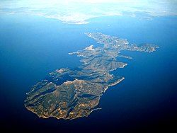
Aerial view of the island of Elba, Monte Capanne, Marciana Marina and Portoferraio.
Satellite image of Silba
Forfatter/Opretter: Morn the Gorn
compass rose from Maps_template-fr.svg: Eric Gaba (Sting - fr:Sting)
Road and rail data from OpenStreetMap, Licens: CC BY-SA 3.0
Map of Capri. Uses terrain data from SRTM3 (http://dds.cr.usgs.gov/srtm/version2_1/SRTM3/Eurasia/N40E014.hgt.zip).
Bitmap version of File:Capri_sights_terrain.svg.
Titel: Poliegos (onbewoond)
Locatie: Kimolos, Griekenland
Datum: juni 2003
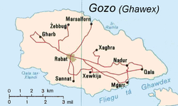
Mapa Gozo z CIA Factbook
Forfatter/Opretter: Goldmund100, Licens: CC BY-SA 3.0
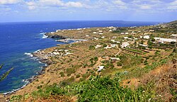
Pantelleria (Italy)
Greek Island Tinos from space
(c) User: Gobbler at wikivoyage shared, CC BY-SA 2.0
Cartina dell'isola di Dugi Otok in Italiano
Forfatter/Opretter: C messier, Licens: CC BY-SA 3.0
Sifnos island airview from west. Altitude around 9 km. The atmosphere was quite dusty and as a result there is a white belt on the horizon
Forfatter/Opretter: Olaf Tausch, Licens: CC BY 3.0
Insel Syros (Σύρος), Gemeinde Syros-Ermoupoli, Kykladen, südliche Ägäis, Griechenland
Forfatter/Opretter: OpenStreetMap/OpenCycleMap + Geraki, Licens: CC BY-SA 3.0
Τοπογραφικός χάρτης της Σαμοθράκης
Forfatter/Opretter: Chrischerf, Licens: CC BY-SA 3.0
Aerial view of the Island Tilos (Greece).
Forfatter/Opretter: Olaf Tausch, Licens: CC BY-SA 3.0
Ruins of the ancient city of Pollentia (Catalan: Pol·lèntia), municipality of Alcúdia, Mallorca, Spain
Forfatter/Opretter: Sky Eckstrom, Licens: CC BY-SA 2.0
Aerial view of Isola del Giglio, looking from the North East
Forfatter/Opretter: Michel Benoist, Licens: CC BY 2.5
La forteresse ottomane de l'île d'Arouad (Syrie), A servi un temps de prison pendant le mandat Français en 1920.
Thasos Island, Greece
- Thasos (Thassos) Island, famous in antiguity for its gold and marble lies 4 miles (6 km) off the coast of Greece in the northern Aegean Sea. Covering an area of 170 sq. miles (440 sq. km), the rugged, forested, mountainous island is composed of marble and gray green gneiss. Numerous sandy beaches dot the island. Ample rainfall in autumn and winter sustains the dense vegetation, which covers the landscape and makes the island a popular vacation resort area. Thasos Island is now famous for its honey as beehives are in evidence throughout the island. The long airport runway at Kavala Khrisoupolis Airport on mainland Greece is visible near the bottom center of the image.
Forfatter/Opretter: Pitichinaccio, Licens: CC BY-SA 3.0
Megalonisos Island, Petalii Group, Southern Euboean Gulf, Greece
(c) User: Mediterranean.web at wikivoyage shared, CC BY-SA 3.0
Luftbild Insel Pantelleria
Forfatter/Opretter: stefan_fotos from Leipzig, Germany, Licens: CC BY-SA 2.0
A journey to the Aeolian islands.
Island of LipariKrk
Forfatter/Opretter: Frente, Licens: CC BY-SA 3.0
Olymbos, the traditional "Chora" of Karpathos, own foto, May 2005
Forfatter/Opretter: User:FocalPoint, Licens: CC BY-SA 3.0
Grecka wyspa Makronisos, przedstawiona tak, jak widywana jest również podczas lotów rejsowych z Polski. Zdjęcie wykonano w momencie zwrotu samolotu, czyli niezwłocznie po minięciu przylądka Sounio. Po lewej stronie fotografii widoczny jest brzeg Attyki, na nim m.in. zewnętrzne fragmenty portu dalekomorskiego w Lawrio. U góry fotografii, czyli już z tyłu za samolotem, oddala się wyspa Evia (Eubea).
Forfatter/Opretter: Carsten Steger, Licens: CC BY-SA 4.0
Aerial image of Stromboli (view from the northeast); to the right, the Sciara del Fuoco located in the northwestern part of the island can be seen; the island of Panarea can be seen in the background
Mission: ISS017 Roll: E Frame: 12893 Mission ID on the Film or image: ISS017
Country or Geographic Name: CRETE
Features: GAVDOS ISLAND
Center Point Latitude: 34.8 Center Point Longitude: 24.1 (Negative numbers indicate south for latitude and west for longitude)
- Image Science and Analysis Laboratory, NASA-Johnson Space Center. "The Gateway to Astronaut Photography of Earth."
- <http://eol.jsc.nasa.gov/scripts/sseop/photo.pl?mission=ISS017&roll=E&frame=12893> (10/03/2009 17:27:00) .
- Send questions or comments to the NASA Responsible Official at jsc-earthweb@mail.nasa.gov
- Curator: Earth Sciences Web Team
- Notices: Web Accessibility and Policy Notices, NASA Web Privacy Policy
Forfatter/Opretter: No machine-readable author provided. NormanEinstein assumed (based on copyright claims)., Licens: CC BY-SA 3.0
A map of Asinara island off the northwest coast of Sardinia, Italy.
Created by NormanEinstein, July 15, 2005.The Greek islands Kephalonia on first row, Ithaka on it north-east side, Lefkada further away and continental Greece on its right - with Meganisi between them. Produced with NASA World Wind
Forfatter/Opretter: Salvatore88, Licens: CC BY 2.0
Monte Fossa delle Felci e Monte dei Porri (Salina, Sicilia, Italia)
Milazzo 2005 301
Island of Croatia - Croatia - Mljet.PNG
NASA astronaut image of Bozcaada Island (Turkey) in Aegean Sea.
Forfatter/Opretter: John Karakatsanis, Licens: CC BY-SA 2.0
View of thw main town of Skopelos as seen from my house
Forfatter/Opretter: No machine-readable author provided. Shardan assumed (based on copyright claims)., Licens: CC BY 2.5
Sardinia Italy Tavolara island from "Cala Ginepro" - San Teodoro - OT
- Own work - august 2006 --Shardan 17:08, 14 September 2007 (UTC)
Forfatter/Opretter: Juanlu Gonzalez, Licens: CC BY-SA 3.0
Vista del islote de Perejil desde la costa africana
(c) User: Bgabel at wikivoyage shared, CC BY-SA 3.0
Lage der Insel Anafi in den Kykladen
Forfatter/Opretter: The original uploader was Ggia at græsk Wikipedia., Licens: CC BY-SA 2.5
Το χωριό Σχοινούδι (Dereköy). Η φωτογραφία ανήκει σε εμένα και βρίσκεται στο άρθρο του blog μου: http://eggs-in-art.blogspot.com/2007/06/2007-dereky.html.
Vlora
Island of Croatia Croatia - Pag.PNG
Satellite image of Skiathos, Greek island in the Aegean sea
(c) User: Bgabel at wikivoyage shared, CC BY-SA 3.0
Lage der Insel Amorgos in den Kykladen
Forfatter/Opretter: Simon Reinhardt, Licens: CC BY-SA 3.0
Aerial view of the Greek island of Folegandros taken from a plane on a flight from Mykonos to Crete (Chania airport).
Forfatter/Opretter: Comzeradd, Licens: CC BY-SA 3.0
Waterfall at Mylopotamos (Cythera)


