Williams-Point
Forfatter/Opretter:
Attribution:
Billedet er tagget "Attribution Required", men der blev ikke angivet nogen tilskrivningsoplysninger. Attributionsparameteren blev sandsynligvis udeladt ved brug af MediaWiki-skabelonen til CC-BY-licenserne. Forfattere og ophavsmænd finder et eksempel på korrekt brug af eksempel her. her.
Kredit:
Eget arbejde
Shortlink:
kilde:
størrelse:
2608 x 1952 Pixel (1904914 Bytes)
beskrivelse:
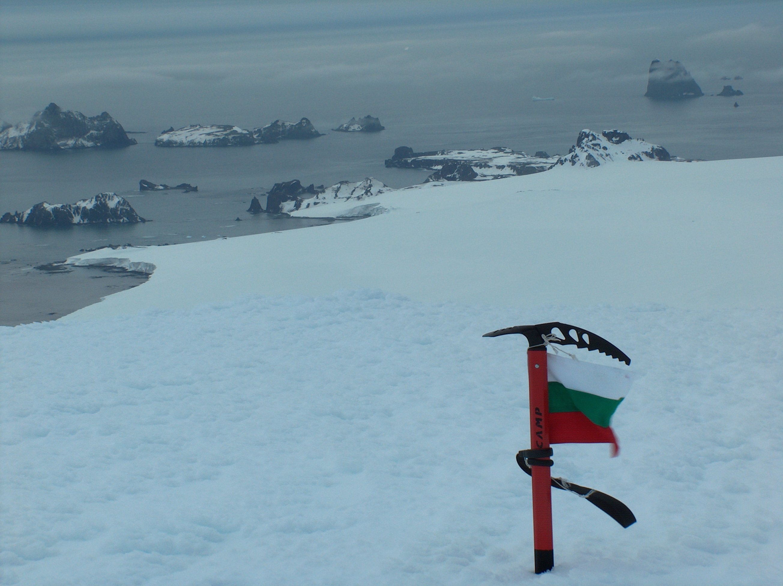
Williams Point, Livingston Island in the South Shetland Islands; the first land ever discovered south of 60˚ south latitude, on February 19, 1819. Left to right Slab Point, Organpipe Point, and Williams Point surmounted by Sayer Nunatak, from Miziya Peak, with Zavala Island in the foreground, Zed Islands in the left background, and Pyramid Island on the right
- Viewpoint location: Miziya Peak in Vidin Heights on Livingston Island, in the South Shetland Islands
- Viewpoint elevation: 604 meters
- Camera: HP PhotoSmart C945 (V01.54)
Licens:
Licensbetingelser:
Creative Commons Attribution-Share Alike 4.0
Yderligere oplysninger om licens til billedet kan findes her. Sidste ændring: Sun, 28 Apr 2024 09:15:25 GMT