WhitePaper
Forfatter/Opretter:
UK Government
Kredit:
Maps relating to the Report of the Anglo-American Committee of Enquiry regarding the problems of European Jewry and Palestine. Suppl. to Cmd. 6808. London: His Majesty's Stationery Office, 1946.
Shortlink:
kilde:
størrelse:
2000 x 3872 Pixel (1997050 Bytes)
beskrivelse:
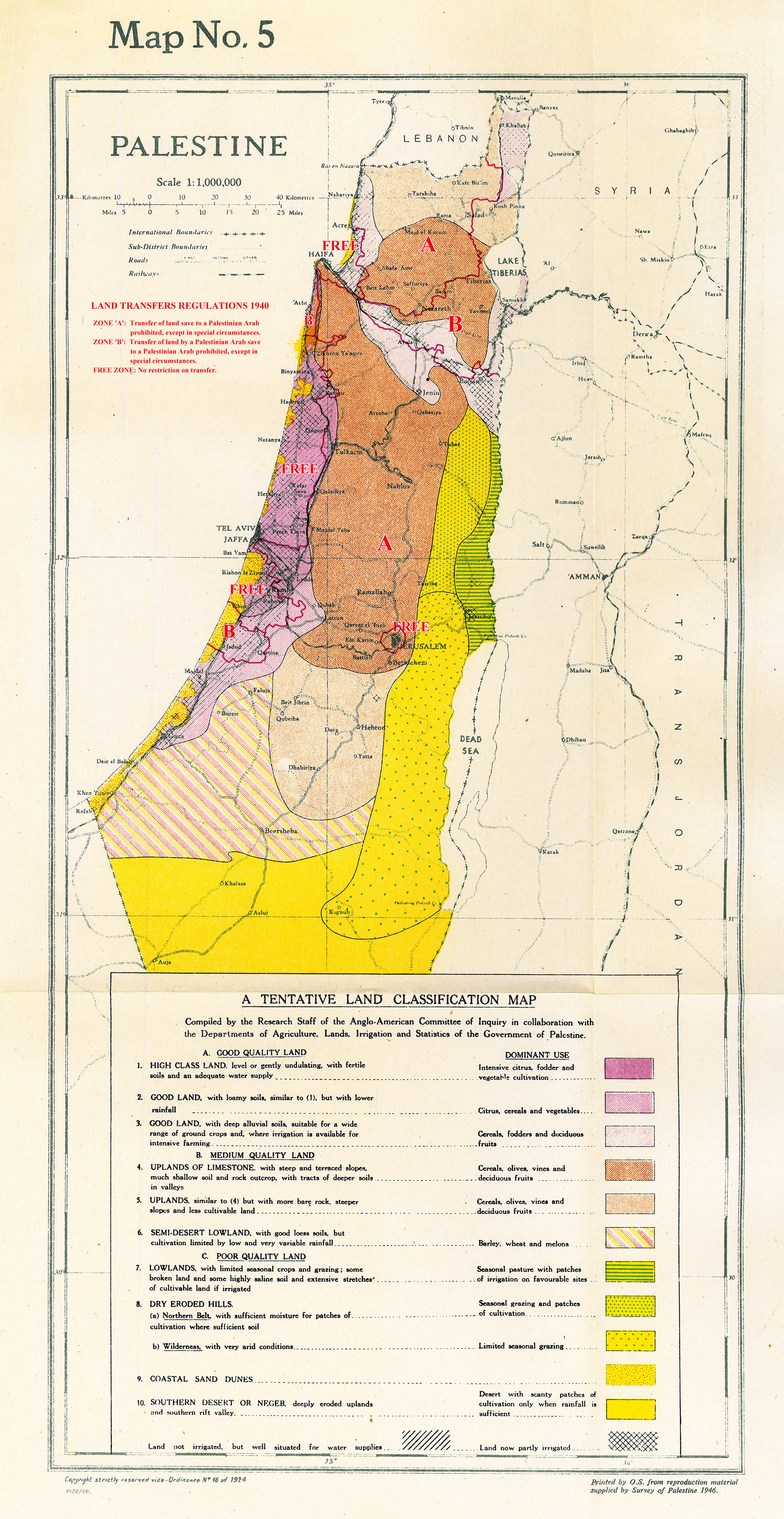
Map 5. Land Classification map of Palestine.
Notated with boundaries of land transfer regions as prescribed in 1940, taken from Map 4.
Licens:
Public domain
Yderligere oplysninger om licens til billedet kan findes her. Sidste ændring: Tue, 13 Feb 2024 12:17:49 GMT