Western Front 1917
Forfatter/Opretter:
United States Military Academy’s Department of History[1]
Kredit:
Shortlink:
kilde:
størrelse:
1242 x 961 Pixel (233585 Bytes)
beskrivelse:
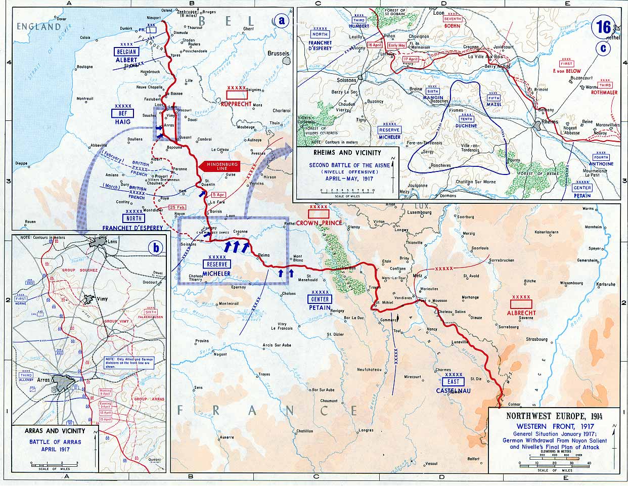
Map of the Western Front, 1917. The red line marks the front as of 5 April 1917. The Siegfriedstellung or Hindenburg Line, only ran from Arras to Laffaux (shown in insert) on the river Aisne - essentially the portion to the east of the dotted red line marking the 25 February front.
Licens:
Public domain
Kommentar på licensen:
This image is a work of a U.S. military or Department of Defense employee, taken or made as part of that person's official duties. As a work of the U.S. federal government, the image is in the public domain in the United States.
Yderligere oplysninger om licens til billedet kan findes her. Sidste ændring: Mon, 11 Dec 2023 22:25:15 GMT