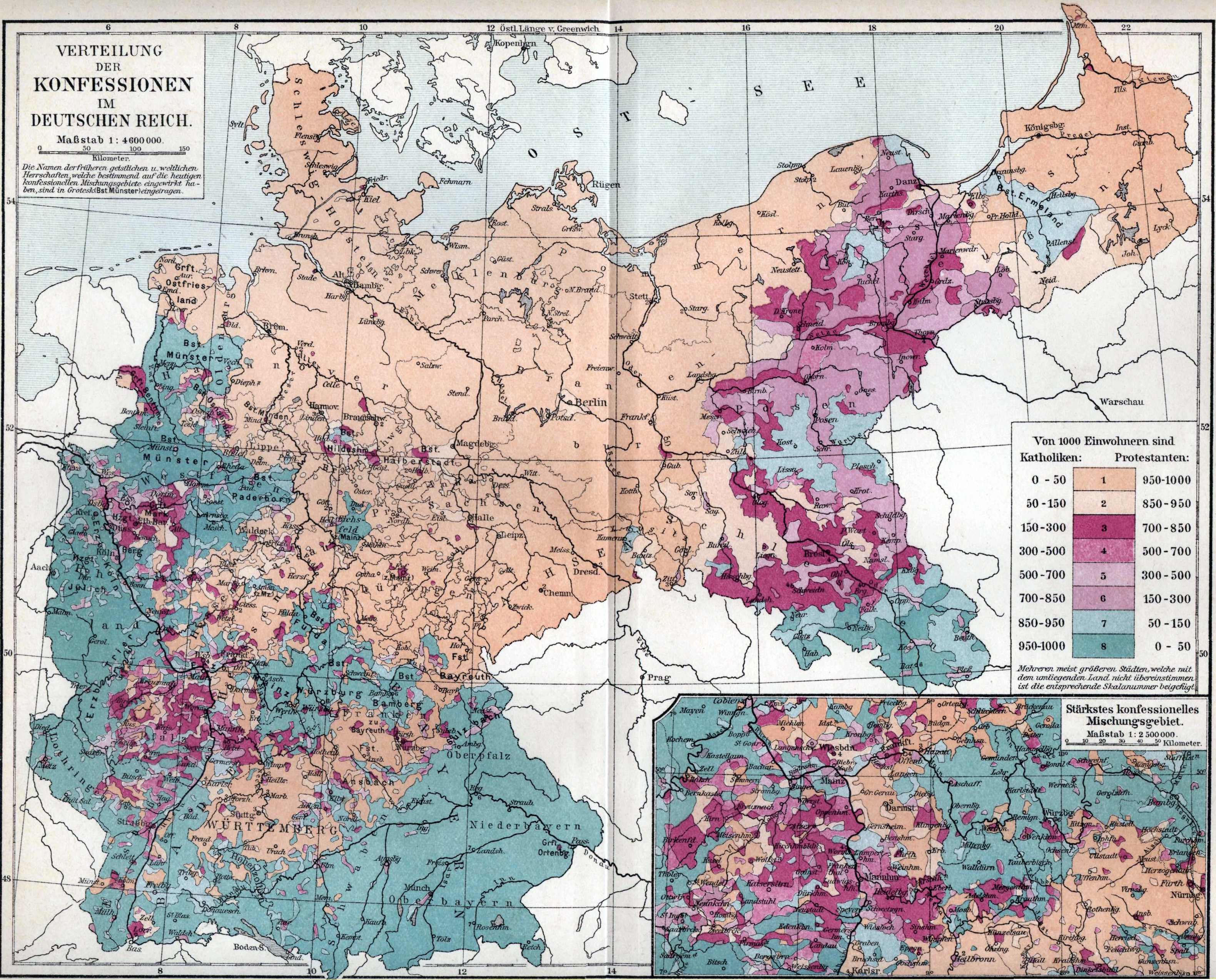
Verbreitung der Konfessionen im deutschen Reich
Forfatter/Opretter:
Meyers Konversationslexikon, 5th edition
Kredit:
Map owned and scanned by Angr
Shortlink:
kilde:
størrelse:
3160 x 2547 Pixel (7014581 Bytes)
beskrivelse:
Map showing distribution of Catholics and Protestants in the German Reich as of the 1890s. For a full discussion of this map, including detailed statistics, from the original source (and written in German), see the talk page.
Licens:
Public domain
Yderligere oplysninger om licens til billedet kan findes her. Sidste ændring: Tue, 30 Apr 2024 08:33:50 GMT