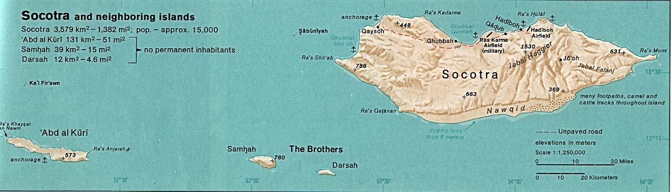
Topographic map of Socotra-en

Forfatter/Opretter:
Oona Räisänen (Mysid)
Attribution:
Billedet er tagget "Attribution Required", men der blev ikke angivet nogen tilskrivningsoplysninger. Attributionsparameteren blev sandsynligvis udeladt ved brug af MediaWiki-skabelonen til CC-BY-licenserne. Forfattere og ophavsmænd finder et eksempel på korrekt brug af eksempel her. her.
Kredit:
Self-made in Inkscape.
Place names based on a public domain CIA map from 1976 (http://www.lib.utexas.edu/maps/islands_oceans_poles/socotra_76.jpg).
Boundaries and opography based on Shuttle Radar Topography Mission data.
Bathymetry from NGDC ETOPO2.
Shortlink:
kilde:
størrelse:
1309 x 375 Pixel (585633 Bytes)
beskrivelse:
Topographic map of Socotra.
Licens:
Licensbetingelser:
Creative Commons Attribution-Share Alike 4.0
Yderligere oplysninger om licens til billedet kan findes her. Sidste ændring: Wed, 10 Apr 2024 20:04:38 GMT