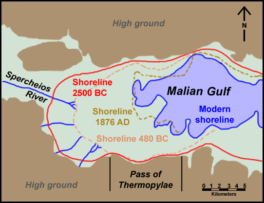
Thermopylae shoreline changes map
Forfatter/Opretter:
Kredit:
Eget arbejde
Shortlink:
kilde:
størrelse:
542 x 417 Pixel (90538 Bytes)
beskrivelse:
Map of Thermopylae area with modern shoreline and reconstructed shorelines of 1872 AD, 480 BC and 2500 BC. Loosely based on figure 3.19 in Geoarchaeology: The Earth-science Approach to Archaeological Interpretation, p. 96. George Robert Rapp, Christopher L. Hill. Yale University Press, 2006. ISBN 0300109660
Licens:
Public domain
Yderligere oplysninger om licens til billedet kan findes her. Sidste ændring: Fri, 26 Apr 2024 18:40:18 GMT