The Beverley Gate - geograph.org.uk - 624987
Forfatter/Opretter:
Kredit:
From geograph.org.uk
Shortlink:
kilde:
størrelse:
640 x 436 Pixel (95552 Bytes)
beskrivelse:
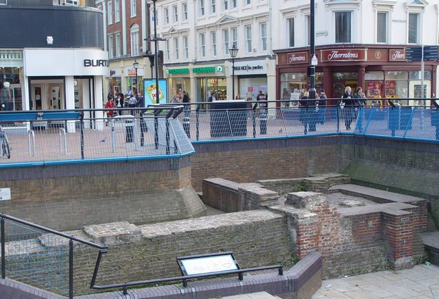
The Beverley Gate, Hull, East Riding of Yorkshire, England.
The old town of Hull was protected by a fortified wall, part of which is seen here. The walls were taken down and used for lining the docks when their defensive value was reduced by the invention of gunpowder.
The old town of Hull was protected by a fortified wall, part of which is seen here. The walls were taken down and used for lining the docks when their defensive value was reduced by the invention of gunpowder.
This site, the Beverley Gate, is the position where (in April 1642) the governor of Hull, Sir John Hotham denied King Charles access to town (and hence to the arsenal of weapons), this being one of the acts which precipitated the English civil war.
Beyond the site the streets are left Alfred Gelder Street, straight on to Whitefriargate, and right to Princes Dock Street.
Licens:
Kommentar på licensen:
Creative Commons Attribution Share-alike license 2.0
Licensbetingelser:
Creative Commons Attribution-Share Alike 2.0
Yderligere oplysninger om licens til billedet kan findes her. Sidste ændring: Mon, 22 Apr 2024 20:43:59 GMT