Tamis banat1718 1739
Forfatter/Opretter:
Kredit:
Eget arbejde
Shortlink:
kilde:
størrelse:
1008 x 1298 Pixel (149962 Bytes)
beskrivelse:
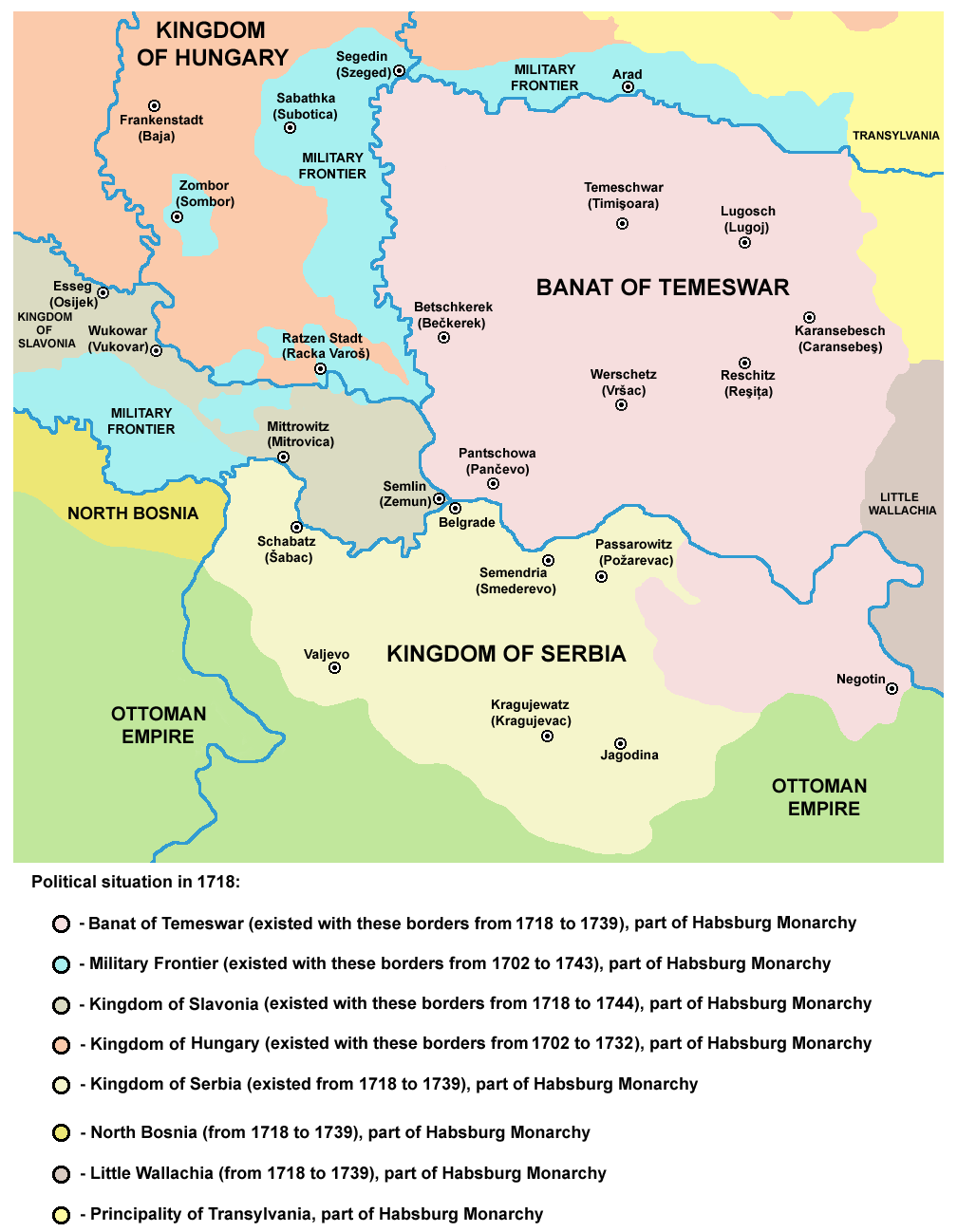
Map of the Banat of Temeswar, Kingdom of Serbia and Military Frontier in 1718.
Serbian: Мапа Тамишког Баната, Краљевине Србије и војне границе 1718. године.
Serbian: Мапа Тамишког Баната, Краљевине Србије и војне границе 1718. године.
Licens:
Public domain
Yderligere oplysninger om licens til billedet kan findes her. Sidste ændring: Sun, 05 May 2024 13:42:29 GMT