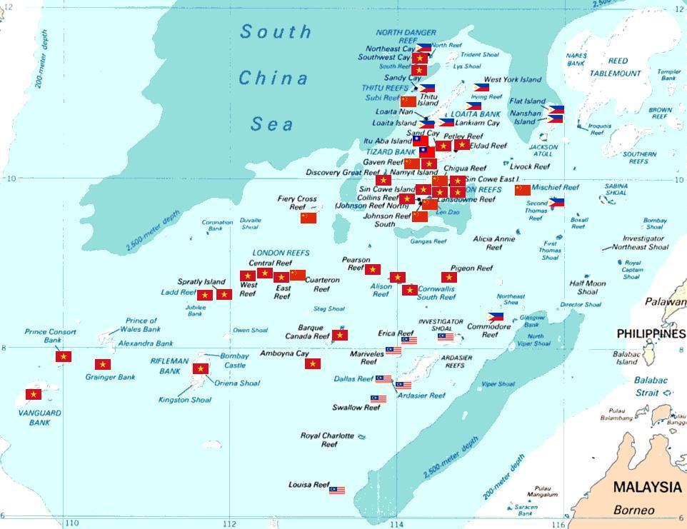
Spratly with flags
Spratly islands map showing occupied features marked with the flags of countries occupying them.
![]() Philippines
Philippines
![]() Republic of China (Taiwan)
Republic of China (Taiwan)
![]() Vietnam
Vietnam
![]() Malaysia
Malaysia
![]() People's Republic of China
People's Republic of China
The flags are placed such that no text and other flag is overlapped. Hence, some flags are not in the exact coordinates where they should actually lie. However, they still portray the general picture on how Spratly Islands are divided among claimant nations. All occupied features are placed with flags, including those which are not labeled in the map. Here are all unlabeled features:
Ban Than Reef (T) The flag below the flag for Itu Aba Island (T).
Higgens Reef (V) The flag sandwiched between the flags for Sin Cowe Island (V) and Landsowne Reef (V).
Whitson Reef (C) The flag nearest Chigua Reef label. Based on coordinates of Whitson Reef which is 10°00'N 114°43'E, it should lie there.
Kennan Reef (C) The flag nearest the flag for Johnson South Reef (C).
Yderligere oplysninger om licens til billedet kan findes her. Sidste ændring: Wed, 10 Apr 2024 20:05:23 GMT