Spitalfields rookery
Forfatter/Opretter:
Ordnance Survey, modified by uploader
Kredit:
Original map downloaded from http://www.casebook.org/official_documents/map/images/ord_map_full.jpg
Shortlink:
kilde:
størrelse:
800 x 417 Pixel (470302 Bytes)
beskrivelse:
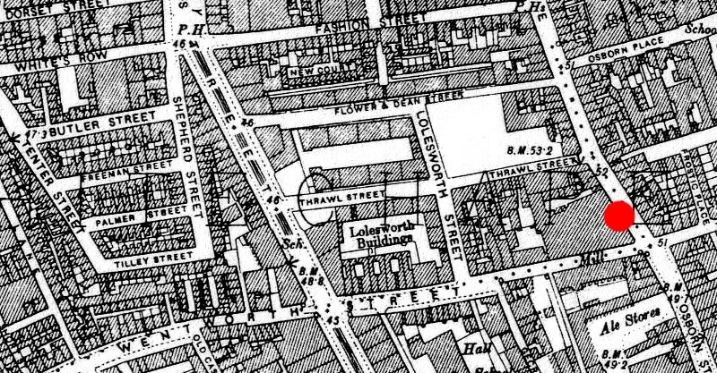
1894 ordnance survey map of Whitechapel showing the area around en:Spitalfields where many common lodging-houses were situated in the late Victorian era. Red circle indicates the location at the junction of Osborn Street and en:Brick Lane near where en:Emma Elizabeth Smith (the first en:Whitechapel murders victim) was attacked. The building to the immediate west of the red circle is a chocolate factory.
Licens:
Public domain
Kommentar på licensen:
This work created by the United Kingdom Government is in the public domain.
This is because it is one of the following:
- It is a photograph taken prior to 1 June 1957; or
- It was published prior to 1974; or
- It is an artistic work other than a photograph or engraving (e.g. a painting) which was created prior to 1974.
HMSO has declared that the expiry of Crown Copyrights applies worldwide (ref: HMSO Email Reply)
More information.
Yderligere oplysninger om licens til billedet kan findes her. Sidste ændring: Thu, 09 May 2024 14:43:42 GMT