Seven+Summits+Elevation+World+Map
Forfatter/Opretter:
Base image: National Oceanic and Atmospheric Administration
Tagged: Ma xyz
Kredit:
Own work based on Image:Elevation.jpg
Original file from https://www.ngdc.noaa.gov/mgg/image/2minrelief.html
Shortlink:
kilde:
størrelse:
1524 x 762 Pixel (1853795 Bytes)
beskrivelse:
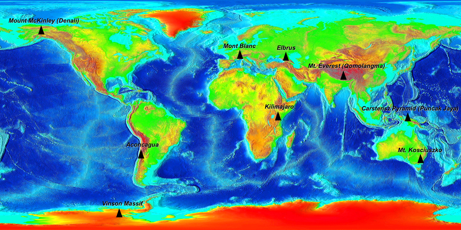
The Seven Summits on an Elevation World Map. (For more information on why 9 peaks are on this map read the wikipedia Seven Summits article.)
Elevation key: Green < 500m, Yellow <1000m, Orange <2000m, Red <3000m, Dark Red <5000m, Grey >5000m
Licens:
Public domain
Yderligere oplysninger om licens til billedet kan findes her. Sidste ændring: Sun, 21 Apr 2024 07:01:01 GMT