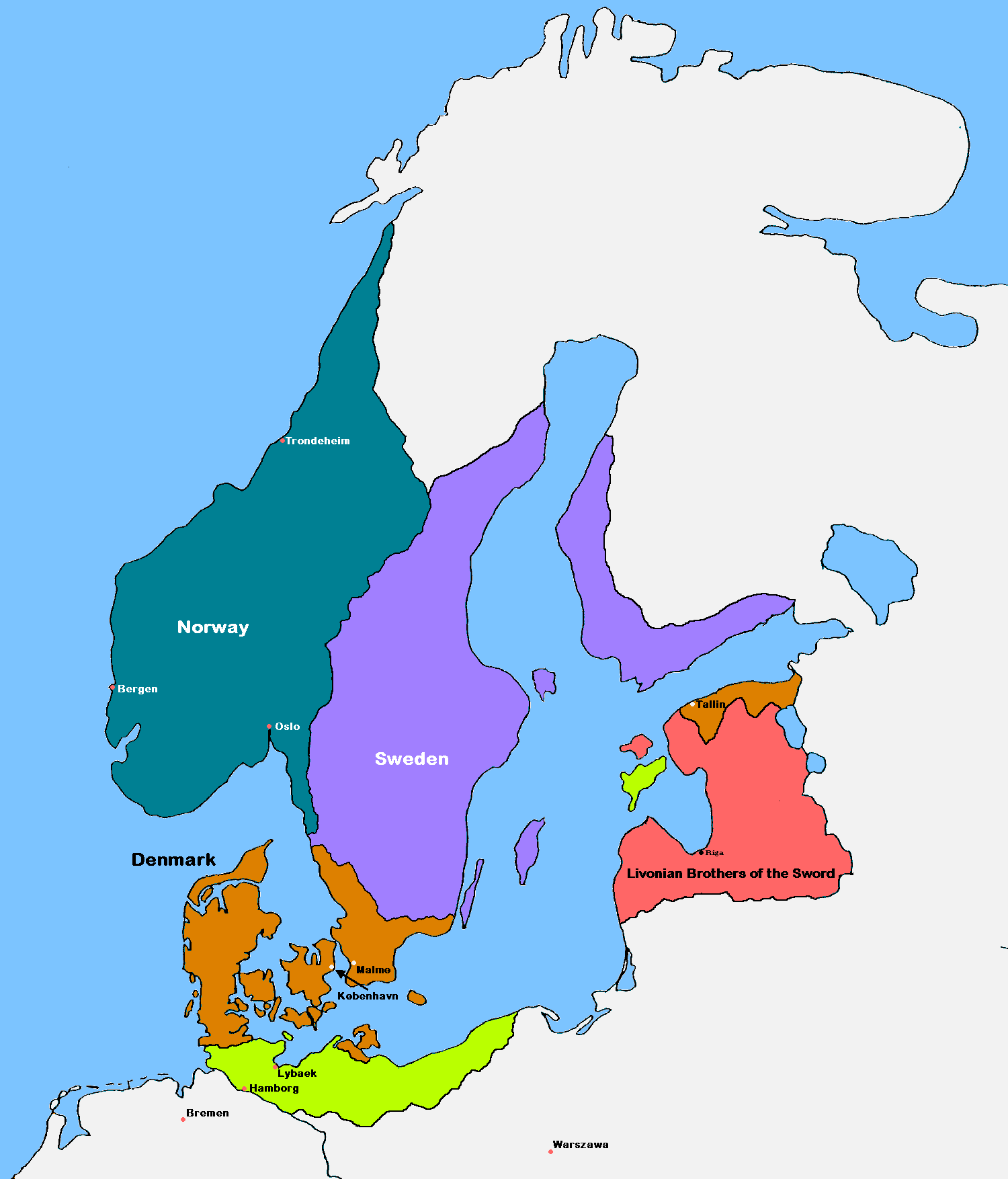
Scandinavia1219
Forfatter/Opretter:
Attribution:
Billedet er tagget "Attribution Required", men der blev ikke angivet nogen tilskrivningsoplysninger. Attributionsparameteren blev sandsynligvis udeladt ved brug af MediaWiki-skabelonen til CC-BY-licenserne. Forfattere og ophavsmænd finder et eksempel på korrekt brug af eksempel her. her.
Kredit:
- Original image: File:Scandinavia in 1219.GIF
Shortlink:
kilde:
størrelse:
1500 x 1754 Pixel (42391 Bytes)
beskrivelse:
Update of the historical and political map, created in 2005 by Kasper Holl. It is a compressed format, has an easier colour scheme and has greater sized labels. NB on accuracy: Sweden did not reach this size until after the 1330s, when colonialization of Västerbotten started. Swedish colonialization of Finnish coast started before 1250. Sweden lost Gotland to Denmark in 1361. Trondheim has a wrong placement on map.
Licens:
Licensbetingelser:
Creative Commons Attribution-Share Alike 3.0
Yderligere oplysninger om licens til billedet kan findes her. Sidste ændring: Sun, 21 Apr 2024 20:07:52 GMT