Sahel Map-Africa rough
Forfatter/Opretter:
Attribution:
Billedet er tagget "Attribution Required", men der blev ikke angivet nogen tilskrivningsoplysninger. Attributionsparameteren blev sandsynligvis udeladt ved brug af MediaWiki-skabelonen til CC-BY-licenserne. Forfattere og ophavsmænd finder et eksempel på korrekt brug af eksempel her. her.
Kredit:
Felix Koenig: "created/photographed by myself (based on the existing blank map of Africa)"
- Photographer/illustrator: Felix Koenig (King)Blank map of Africa Map_sahel.jpg
- BlankMap-Africa2.png
Shortlink:
kilde:
størrelse:
2000 x 925 Pixel (297842 Bytes)
beskrivelse:
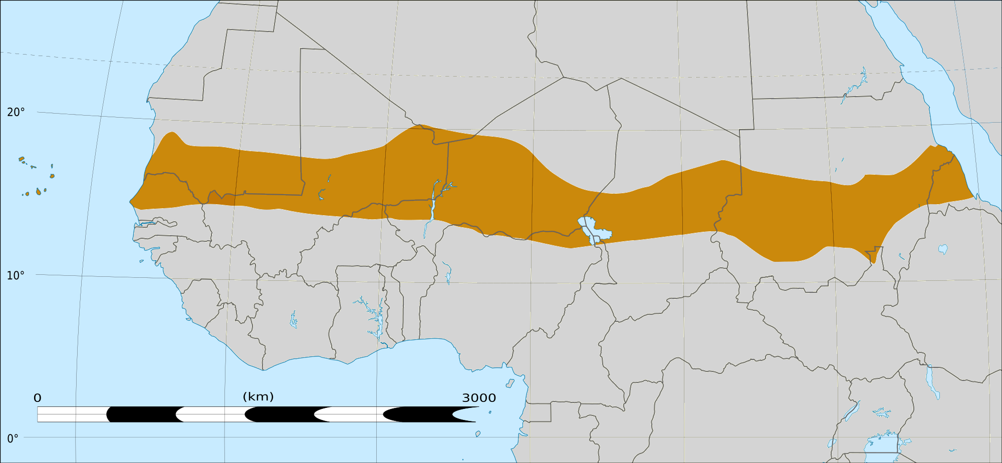
Map of Africa, with the Sahel highlighted in orange.
This is roughly the African land area between the lines of 200mm (north) and 600mm (south) mean 20th century annual rainfall. This is limited to land areas directly to the south of the Sahara desert and including the islands of Cape Verde, but not including other areas in Africa with the same rainfall statistics. This is one, but not the only, definition of the Sahel region.
Licens:
Licensbetingelser:
Creative Commons Attribution-Share Alike 4.0
Yderligere oplysninger om licens til billedet kan findes her. Sidste ændring: Mon, 12 Aug 2024 00:17:47 GMT