RossIslandMap
Forfatter/Opretter:
USGS
Kredit:
Shortlink:
kilde:
størrelse:
1000 x 800 Pixel (169538 Bytes)
beskrivelse:
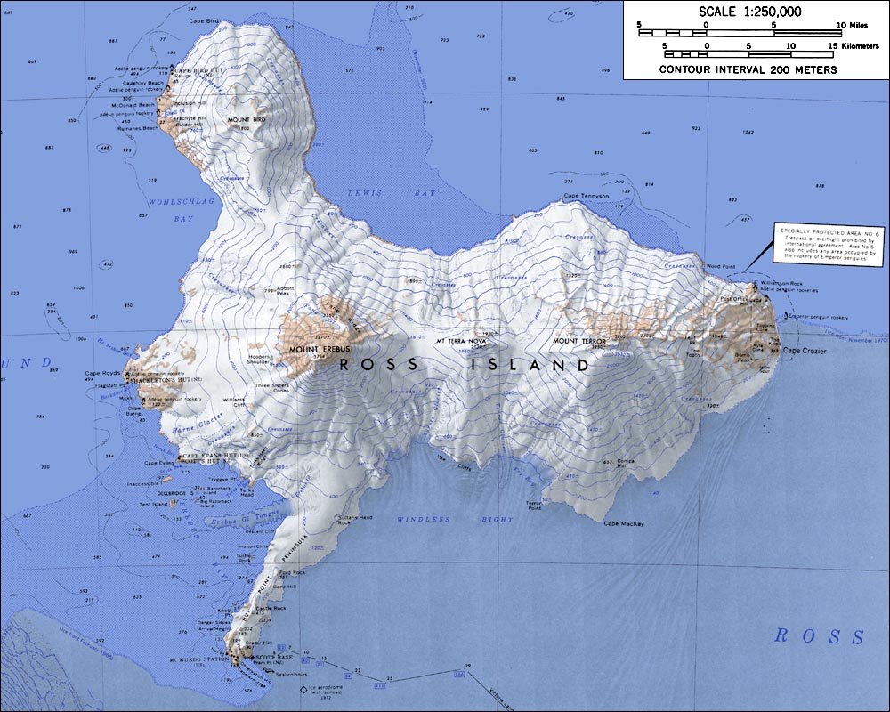
Topographic map of Ross Island, Antarctica (1:250,000 scale)
Licens:
Public domain
Yderligere oplysninger om licens til billedet kan findes her. Sidste ændring: Sun, 06 Nov 2022 01:22:12 GMT