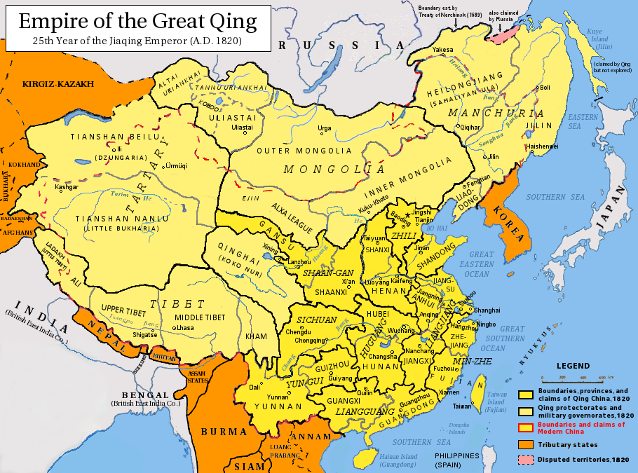
Qing Dynasty 1820
Forfatter/Opretter:
Attribution:
Billedet er tagget "Attribution Required", men der blev ikke angivet nogen tilskrivningsoplysninger. Attributionsparameteren blev sandsynligvis udeladt ved brug af MediaWiki-skabelonen til CC-BY-licenserne. Forfattere og ophavsmænd finder et eksempel på korrekt brug af eksempel her. her.
Kredit:
Eget arbejde
Shortlink:
kilde:
størrelse:
910 x 675 Pixel (407583 Bytes)
beskrivelse:
Map of the Qing Dynasty in 1820, representing its stablized territory from 1790-1839. (Includes provincial boundaries and the boundaries of modern China for reference.) Provinces in yellow, military governorates and protectorates in light yellow, tributary states in orange.
Adapted from File:ROC_PRC_comparison_eng.jpg and information complied from:
Adapted from File:ROC_PRC_comparison_eng.jpg and information complied from:
- http://baike.baidu.com/view/5405.htm
- http://map.huhai.net/58-59.jpg
- http://www.sina7.com/jdwh/UploadFiles_6109/200709/20070918093610860.jpg
- File:China_and_Japan,_John_Nicaragua_Dower_(1844).jpg
- File:Carte_generale_de_l'Empire_Chinois_et_du_Japon_(1836).jpg
- File:Empire_Chinois,_Japon_(1832).jpg
- File:L'Empire_Chinois_et_du_Japon_(1833).jpg
- http://city.udn.com/3011/4192243?tpno=48&cate_no=0
- http://bbs.godeyes.cn/showtopic-371673.aspx
Licens:
Licensbetingelser:
Creative Commons Attribution-Share Alike 3.0
Yderligere oplysninger om licens til billedet kan findes her. Sidste ændring: Mon, 01 Apr 2024 13:40:07 GMT
