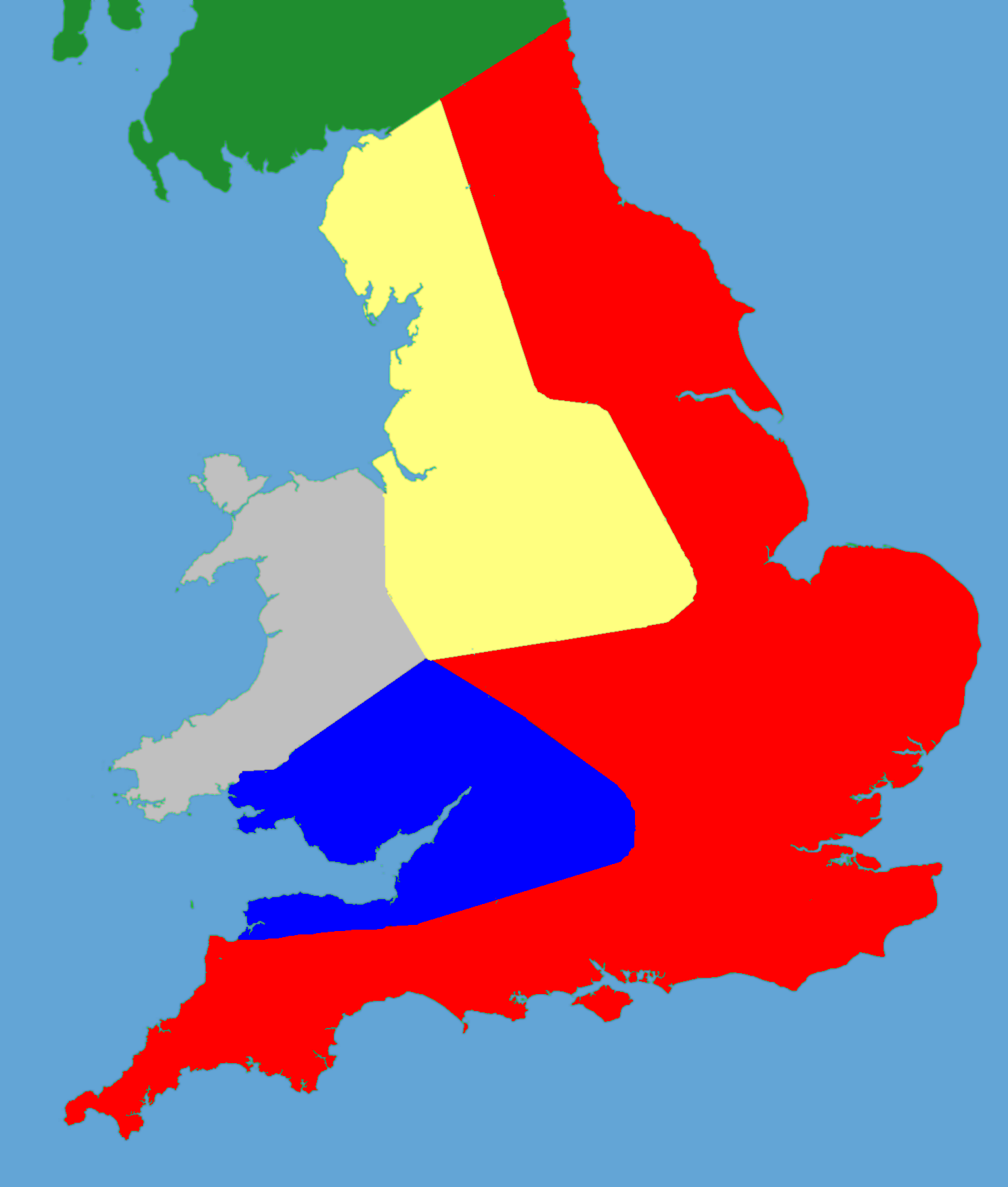
Political map of England 1153
Forfatter/Opretter:
- Gb4dot.svg: Wereon
- derivative work: Hchc2009 (talk)
Kredit:
Own work using:
- File:Gb4dot.svg (The idea is to superimpose Image:dot4gb.svg at the appropriate point. See w:Template:GBthumb for code to do this. These two images can replace any locator map posted by Lupin - see w:Special:Contributions/LupinBot. This is a vectorized version of Image:Gb4dot.png, with the scale changed from 200 km to 150 km/150 miles. The shoreline data come from the file gshhs_h.b from the GSHHS, and the rivers and the Irish border come from the CIA World DataBank II; both sources are in the public domain. Mercator projection.)
- Data: Jim Bradbury's book "Stephen and Matilda", p. 180.
Shortlink:
kilde:
størrelse:
1489 x 1753 Pixel (222440 Bytes)
beskrivelse:
A political map of southern Britain in 1153
Licens:
Public domain
Yderligere oplysninger om licens til billedet kan findes her. Sidste ændring: Wed, 14 Feb 2024 06:42:36 GMT