Poland & The New Baltic States
Forfatter/Opretter:
London Geographical Institute
Kredit:
This uploaded map is a photoshopped version of the original image located at Image:London-geographical-institute the-peoples-atlas 1920 poland-and-the-new-baltic-states.jpg or [1].
Originally uploaded to EN Wikipedia as en:Image:Poland & The New Baltic States.jpg by en:User:MaGioZal 26 December 2007
Shortlink:
kilde:
størrelse:
1376 x 1784 Pixel (1274136 Bytes)
beskrivelse:
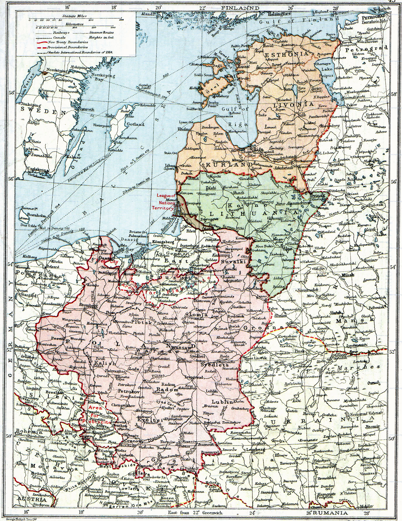
Map of Poland, en:Lithuania, en:Courland, en:Livonia and en:Esthonia published in the 1920 edition of The Peoples Atlas by London Geographical Institute.
The map shows the situation after the treaties of Versailles and Brest-Litovsk and before the en:Peace of Riga and the organization and recognition of the nation-states of en:Estonia and en:Latvia.
Note that most names featured on this map are pre-1914 Russian names put in English transcription, rather than local or English names as such.
Licens:
Public domain
Kommentar på licensen:
According to the site, there are no copyrights to this map.
Yderligere oplysninger om licens til billedet kan findes her. Sidste ændring: Sat, 13 Jan 2024 21:14:03 GMT