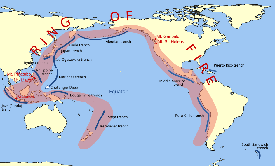
Pacific Ring of Fire
Kredit:
vector data from [1]
Shortlink:
kilde:
størrelse:
942 x 569 Pixel (301485 Bytes)
beskrivelse:
Volcanic arcs and oceanic trenches partly encircling the Pacific Basin form the so-called Pacific Ring of fire, a zone of frequent earthquakes and volcanic eruptions. The trenches are shown in blue-green. The volcanic island arcs, although not labelled, are parallel to, and always landward of, the trenches. For example, the island arc associated with the Aleutian Trench is represented by the long chain of volcanoes that make up the Aleutian Islands. (SVG version of File:Pacific_Ring_of_Fire.png, recreated by Gringer using WDB vector data using code mentioned in File:Worldmap_wdb_combined.svg.)
Licens:
Public domain
Yderligere oplysninger om licens til billedet kan findes her. Sidste ændring: Wed, 21 Feb 2024 03:41:03 GMT
