Operation Tractable
Forfatter/Opretter:
Kredit:
Eget arbejde
Shortlink:
kilde:
størrelse:
550 x 672 Pixel (139027 Bytes)
beskrivelse:
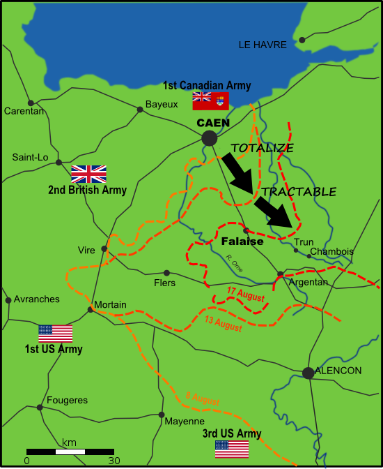
Map of Allied and German positions around Falaise, Normandy from 8-17 August 1944, illustrating the Canadian offensives of Operation Totalize and Operation Tractable.
Licens:
Public domain
Yderligere oplysninger om licens til billedet kan findes her. Sidste ændring: Sat, 20 Apr 2024 22:43:22 GMT