Nargis 2008 track
Forfatter/Opretter:
Kredit:
Created by Ramisses using Wikipedia:WikiProject Tropical cyclones/Tracks. The background image is from NASA. Tracking data is from the Joint Typhoon Warning Center[1].
Shortlink:
kilde:
størrelse:
2700 x 1669 Pixel (4869569 Bytes)
beskrivelse:
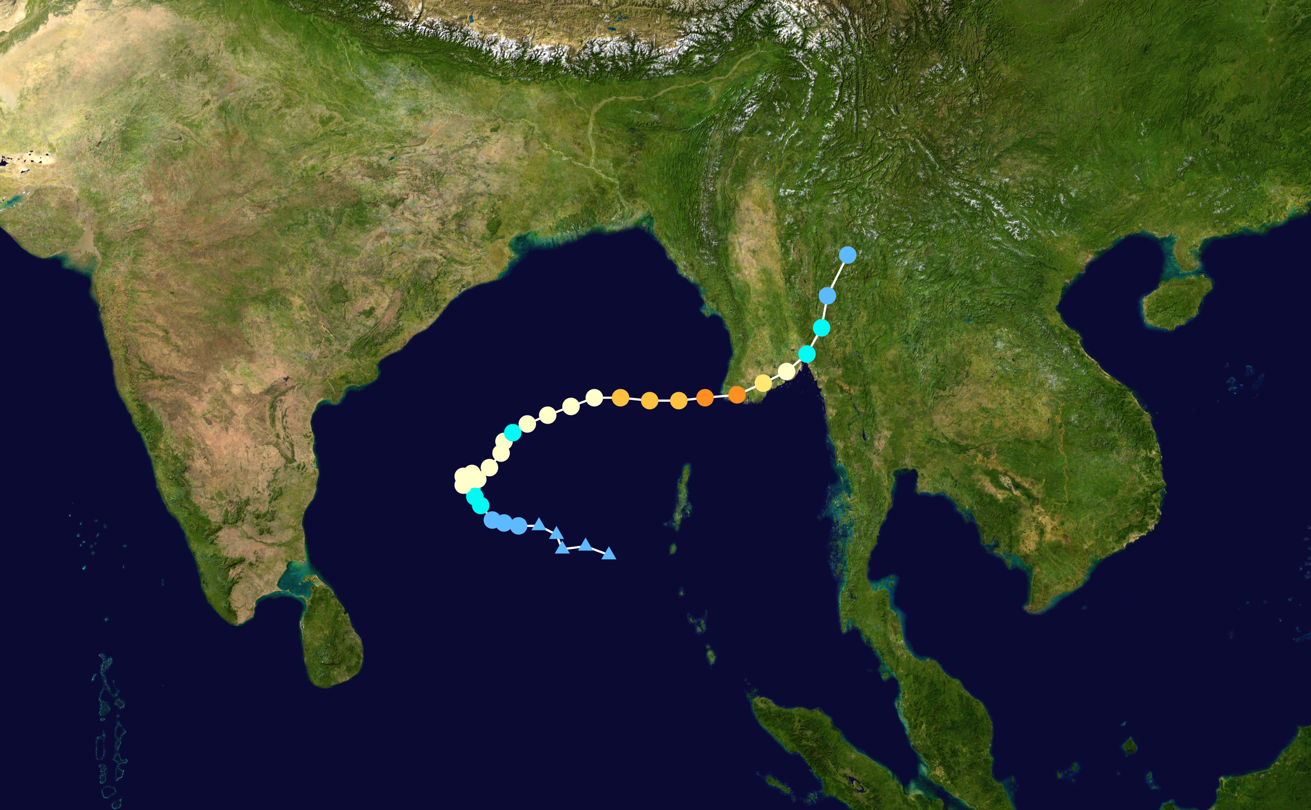
Track map of Extremely Severe Cyclonic Storm Nargis of the 2008 North Indian Ocean cyclone season. The points show the location of the storm at 6-hour intervals. The colour represents the storm's maximum sustained wind speeds as classified in the (see below), and the shape of the data points represent the nature of the storm, according to the legend below.
 Extratropical cyclone / Remnant low / Tropical disturbance / Monsoon depression
Tropical depression (≤38 mph, ≤62 km/h)
Tropical storm (39–73 mph, 63–118 km/h)
Category 1 (74–95 mph, 119–153 km/h)
Category 2 (96–110 mph, 154–177 km/h)
Category 3 (111–129 mph, 178–208 km/h)
Category 4 (130–156 mph, 209–251 km/h)
Category 5 (≥157 mph, ≥252 km/h)
Unknown
Storm type
Licens:
Public domain
Yderligere oplysninger om licens til billedet kan findes her. Sidste ændring: Sat, 25 Nov 2023 19:31:47 GMT