Nalunaq Gold Mine (looking southwest) Greenland
_Greenland.jpg?uselang=da)
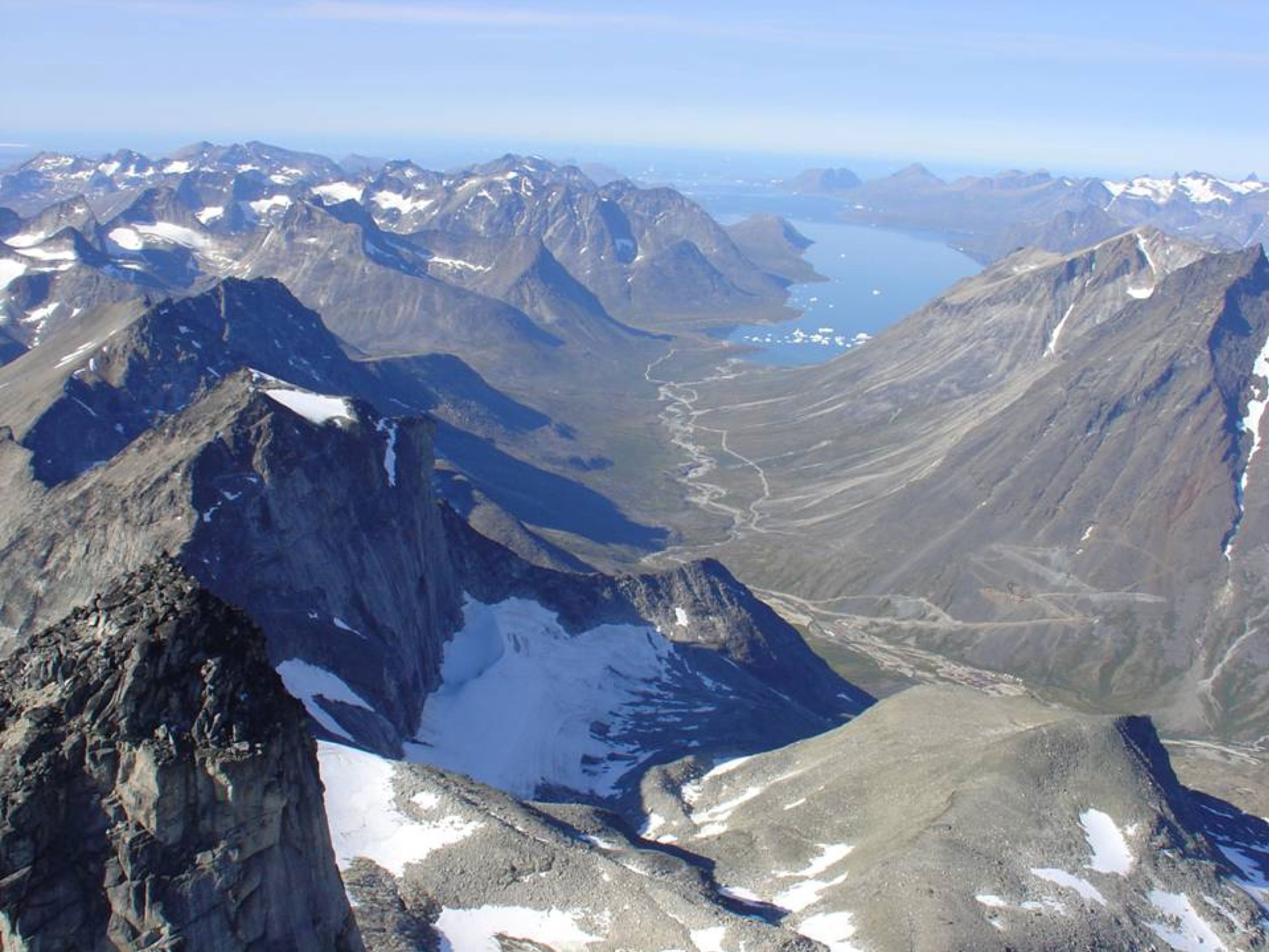
Nalunaq Gold Mine (looking SW) - mine adits are located along the steep slopes of the tall mountain on the right side of the photo (see switchback roads at center-right) (photo generously provided by Nalunaq Gold Mine).
The Nalunaq Gold Mine is Greenland’s first gold mine. It's located 33 km northeast of Nanortalik, in the Ketilidian Orogenic Belt of southern Greenland (60º 21’ 29” N, 44º 50’ 11” W). The deposit was discovered in 1992 and mining commenced in 2004. Mining targets the “Main Vein”, a quartz-gold hydrothermal vein emplaced in a 1 to 2 meter wide shear zone (a regional thrust fault). Shear zone hydrothermal quartz-gold occurrences are frequently referred to as “Mother Lode-type gold deposits”, in reference to the Mother Lode of California.
Hanging wall rocks at the Nalunaq Mine are Paleoproterozoic amphibolite-facies metadolerites and metavolcanics. Footwall rocks are volcanogenic massive sulfides. Quartz-gold mineralization here has been dated to 1.77 to 1.80 billion years ago (late Paleoproterozoic), during the Ketilidian Orogeny.Yderligere oplysninger om licens til billedet kan findes her. Sidste ændring: Mon, 08 Jan 2024 12:12:40 GMT
_Greenland.jpg?uselang=de)