Mergui Archipelago
Forfatter/Opretter:
Attribution:
Billedet er tagget "Attribution Required", men der blev ikke angivet nogen tilskrivningsoplysninger. Attributionsparameteren blev sandsynligvis udeladt ved brug af MediaWiki-skabelonen til CC-BY-licenserne. Forfattere og ophavsmænd finder et eksempel på korrekt brug af eksempel her. her.
Kredit:
Shortlink:
kilde:
størrelse:
4572 x 4572 Pixel (4104565 Bytes)
beskrivelse:
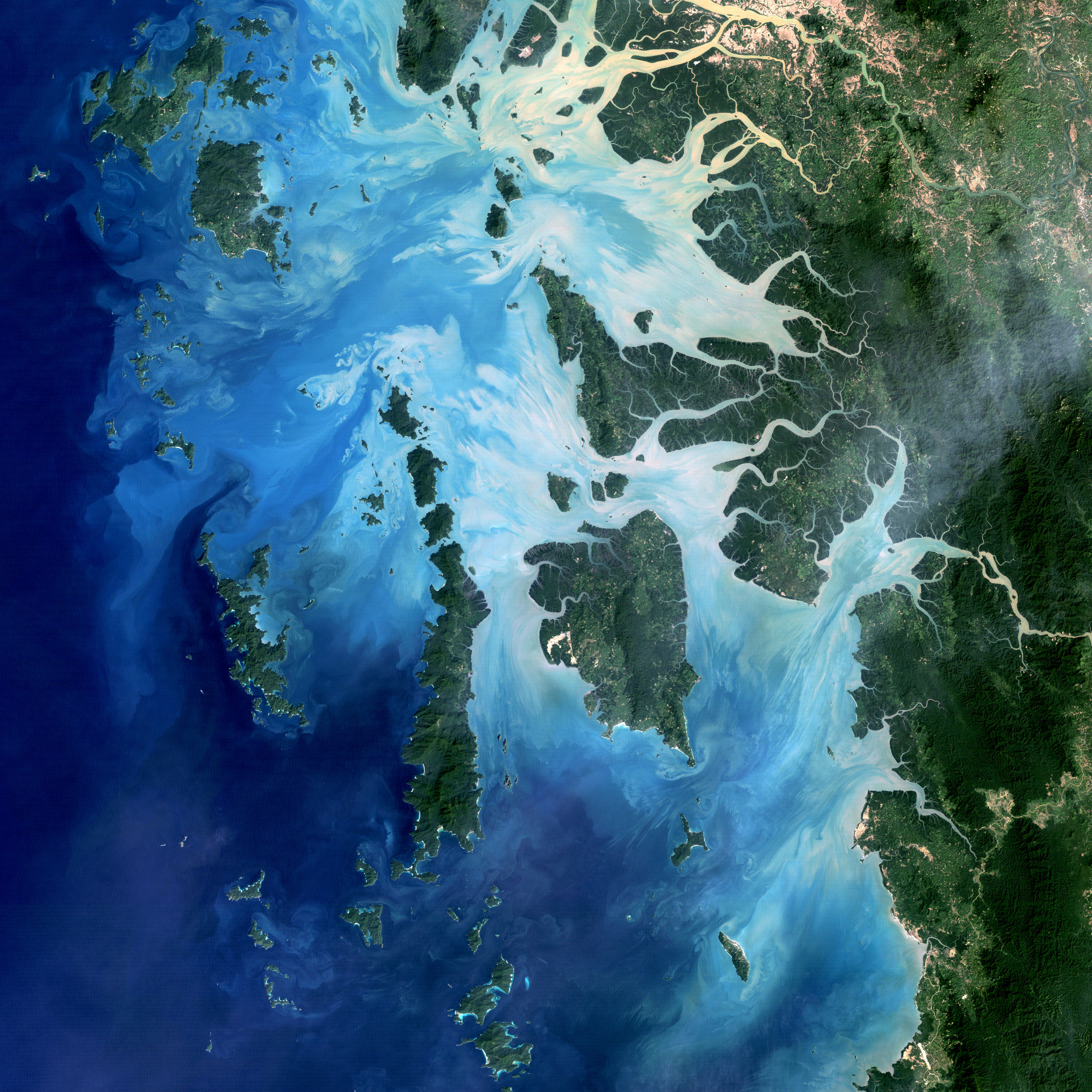
Mergui Archipelago, Myanmar
NASA image acquired December 14, 2004
In the southernmost reaches of Burma (Myanmar), along the border with Thailand, lies the Mergui Archipelago. The archipelago in the Andaman Sea is made up of more than 800 islands surrounded by extensive coral reefs.
Landsat image created by Michael Taylor, Landsat Project Science Office. Caption by Laura Rocchio.
Instrument: Landsat 5 - TM
Credit:NASA Earth Obsevatory
Licens:
Kommentar på licensen:
| This image, which was originally posted to Flickr, was uploaded to Commons using Flickr upload bot on by Lepota. On that date, it was confirmed to be licensed under the terms of the license indicated. |
|
|
Denne fil er udgivet under Creative Commons Navngivelse 2.0 Generisk-licensen | |
|
Licensbetingelser:
Creative Commons Attribution 2.0
Yderligere oplysninger om licens til billedet kan findes her. Sidste ændring: Fri, 16 Apr 2021 03:29:59 GMT