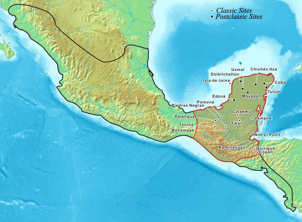
Mayamap
Forfatter/Opretter:
Attribution:
Billedet er tagget "Attribution Required", men der blev ikke angivet nogen tilskrivningsoplysninger. Attributionsparameteren blev sandsynligvis udeladt ved brug af MediaWiki-skabelonen til CC-BY-licenserne. Forfattere og ophavsmænd finder et eksempel på korrekt brug af eksempel her. her.
Kredit:
- Foster, Lynn (2002). Handbook to Life in the Ancient Maya World. New York, US: Oxford University Press. ISBN 978-0-19-518363-4. OCLC 57319740. Page 4.
- Sharer, Robert J.; Loa P. Traxler (2006). The Ancient Maya (6th (fully revised) ed.). Stanford, California, US: Stanford University Press. ISBN 0-8047-4817-9. OCLC 57577446. Page 24.
Shortlink:
kilde:
størrelse:
1074 x 789 Pixel (1034635 Bytes)
beskrivelse:
Map showing the extent of the Maya civilization (red), compared to all other Mesoamerica cultures (black).
- Within Central America and southern North America (Mexico).
- This map also shows the cities and cultural mainsteads of the Maya, who did not have an empire but rather a group of loosely associated city-states.
Licens:
Licensbetingelser:
Creative Commons Attribution-Share Alike 3.0
Yderligere oplysninger om licens til billedet kan findes her. Sidste ændring: Wed, 21 Feb 2024 16:45:42 GMT
