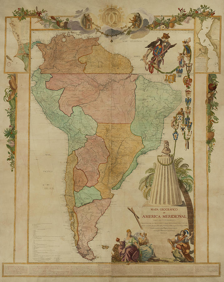
Map of the Viceroyalty of Peru (de jure + de facto)

Forfatter/Opretter:
Attribution:
Billedet er tagget "Attribution Required", men der blev ikke angivet nogen tilskrivningsoplysninger. Attributionsparameteren blev sandsynligvis udeladt ved brug af MediaWiki-skabelonen til CC-BY-licenserne. Forfattere og ophavsmænd finder et eksempel på korrekt brug af eksempel her. her.
Kredit:
- Derivative work from: Map of the Viceroyalty of Peru.svg by Milenioscuro
- Eget arbejde
- File:BlankMap-World-90W.svg
- File:Location_ViceroyaltyPeru.png
- Virreinato del Perú en 1810
- File:Audencias of Viceroyalty of Peru.PNG
- Límite entre Chile y Perú en el río Loa, Plano General del Reyno de Chile en la América Meridional de Andrés Baleato (1793)
- Plano general del Reyno del Perú en la America Meridional de Andrés Baleato (1796)
- Reino de Chile según Juan de la Cruz Cano y Olmedilla, 1775.jpg
- Mapa de Juan de la Cruz Cano y Olmedilla (1775) Pintado
- Historia geográfica e hidrográfica, con derrotero general correlativo al plan del Reino de Chile.pdf
.jpg)
.jpg)
Shortlink:
kilde:
.svg?uselang=da)
størrelse:
3121 x 1586 Pixel (1742866 Bytes)
beskrivelse:
Locator map of the Viceroyalty of Peru (initial (1542) and final, before the splitting of the Captaincy General of Chile (1798) de iure (light green) and de facto (dark green).)
Licens:
Licensbetingelser:
Creative Commons Attribution-Share Alike 3.0
Yderligere oplysninger om licens til billedet kan findes her. Sidste ændring: Wed, 16 Apr 2025 21:15:32 GMT
.svg?uselang=de)